Thursday, January 31, 2019

Winter Karma Hits Snowman Vandals

Somebody drive a truck into this nine-foot tall snowman in Kentucky,
hoping to topple it, but they didn't realize there was a giant
tree stump hidden under it. Somebody has a wrecked truck now. 
Earlier this month, some people in Kentucky celebrated a bout of winter weather by building an eight-foot tall snowman and named it Frosty.

Some idiot decided it would be fun to wreck it by driving their truck into it, says television station WLWT. 

Little did the pickup truck driver know, but the couple who built the snowman supported its base with a huge tree stump. The stump was hidden beneath the snow at Frosty's base.

The result, of course, was karma.

The people who live in the house where Frosty was came home from work to find tire tracks leading to the snowman. The stump beneath Frosty exposed, with an imprint of a bumper stuck into the remaining snow. Plus, Frosty remained standing, tall and proud.

There was surely damage to the pickup truck, but nobody knows who's it is.

It's Not The "Polar Vortex" It's The Yo-Yo Extremes That Wow Me This Winter

Someone flash froze these pants in air that was 20s below
and left them outside to mark the occasion
Uof the worst cold snap in a generation. 
UPDATE: 2 p.m. EST Wednesday.

I'm seeing more reports of some pretty impressive new cold weather records today out in the Midwest.

It looks like there's a new all-time record low temperature for the entire state of Illinois. It reportedly got down to 38 below in Mt. Carroll, Illinois today.

They're going to inspect the Mt Carroll equipment to make sure it's accurate. If it is, that 38 below would break the previous statewide Illinois record low of 36 below in Congerville, set on January 5, 1999.

Moline, Illinois dropped down to 33 below. That broke the city's all-time record low by six degrees. It's very rare to break an all-time record low, but to exceed it by six degrees is absolutely incredible.

We have an update from Rockford, Illinois, which had an all-time record low of 31 below, not 30 below as previously reported. Cedar Rapids, Iowa was at 30 below, a new all-time record for them.

In Michigan, MLive reports some strange things going on inside houses there, and I'm sure this is happening elsewhere. People report frozen water in toilets, ice on indoor electrical outlets, curtains frozen to sliding glass doors and the interior of doors covered in frost.

PREVIOUS DISCUSSION

Yes, yes, I know the cold snap in the Midwest is a memorable, record-breaking weather event.

But what's got me fascinated is not so much the cold wave but the one-extreme-to-another character of this winter. Which actually is a continuation of what we've increasingly seen in this nation and worldwide in recent years and decades.

I had to mention the "Polar Vortex" in the headline of this post because that's all everybody is talking about in relation to this cold snap.  To review, the polar vortex is a normal component of the Arctic winter.

Pieces of the polar vortex sometimes break off and head south. That's also completely normal. Occasionally, these pieces head south into the United States. That's what happened this time.
Again: Normal.

It's just that the particular piece that broke off in recent days and roared south from northern Canada  brought with it air that was even chillier than usual.

And since this piece of the polar vortex raced southward faster than usual, it didn't have time to warm up on its trip south.  That's why the Midwest is seeing record cold.  So there, I've got that out of the way.

The cold is impressive. Cotton, Minnesota reportedly got down to 56 below this morning, which is within four degrees of Minnesota's all time state record for cold. Rockford, Illinois was down to 30 below, that city's coldest reading in history.

Up in International Falls, Minnesota, it was 45 below this morning after a "high" temperature of 19 below on Tuesday.

The Midwest, and eventually us here in Vermont are about to see a spectacular warm up.  In some places, it is said it will warm up at a record pace, whatever that is.  Davenport, Iowa, which was at 27 below this morning, is expecting a high temperaure Sunday of 48 degrees, which is a 75 degree jump.

International Falls, Minnesota is expected to reach 26 degrees Sunday, 71 degrees hotter than it was this morning.

Here in Vermont, the change won't be as extreme. But subzero readings Friday morning will be replaced by highs in the 40s by early next week.
A heavy snow squall in St. Albans, Vermont Wednesday. The
squalls contributed to one of the snowiest Januaries on
record in Burlington, Vermont. 

Speaking of extremes, those snow squalls yesterday covered an amazingly wide area of the Northeast, stretching from Pennsylvania to Massachusetts and Maine.

Some of the squalls caused serious highway pileups in Pennsylvania and New York.  The snow squall that hit my place was one of the most intense I can remember, though, like most snow squalls it was very brief.

The snow squalls added another installment to the month's snow total in Burlington, Vermont. The city has had 41.3 inches of snow this month, making this the third snowiest January on record. You'd never know it, because repeated thaws in this yo-yo winter have cut back on the amount of snow on the ground.  

Caribou, Maine has had 59.8 inches of snow this month, its snowiest January on record.  Meanwhile, Boston, Massachusetts has had only 2.3 inches of snow this winter, which is 20.5 inches below normal.

When I tweeted out Burlington's snow total this morning, Tim Kelley, a meteorologist with NBC10 in Boston and NECN, responded with this very true reply which read in part:

"'Normal' weather does not exist. It's a balance of extremes. Always has been, always will be."

The contrast between snowfall in northern and southern New England is a great example of that. So are the monthly average temperatures in the Midwest for January. Despite the record cold, Minneapolis will have a January, 2019 that will be only about a degree cooler than average. They had a warm start to the month.

In other words, January temperatures in Minneapolis will be  close to "normal."

The sticky question arises when you question whether the extremes that lead to these "normals" are getting more extreme. Climate scientists say they are. To me, judging whether the climate is more extreme than it used to be is sometimes hard to do.

Yes, there are more record highs than record lows lately, even though this week in the United States is chilly. You can measure that. There's evidence that floods, droughts and such are getting worse.

But the causes of months like January in the United States are hard to tease out. How much was due to just the usual randomness of the atmosphere? Did climate change influence any of this, and if so, by how much?

I don't know. The climate scientists will keep studying this. Meanwhile, we just keep bracing ourselves for our roller coaster weather ride, and hope this roller coaster doesn't totally derail.

Wednesday, January 30, 2019

Snow Squalls Moving Through Vermont Late This Afternoon; Be Careful

Very dark clouds in the distance looking west from St. Albans,
Vermont earlier this afternoon as snow squalls gathered
steam and headed toward Vermont. It snowed hard in St. Albans
about 90 minutes after this photo was taken. 
Snow squalls along an Arctic front were moving through Vermont late this afternoon. They were in the Champlain Valley as of 4:15 p.m. and heading east.  

Do know that visibility will go down to near zero during these brief but intense episodes and roads quickly slicken up. If you can wait to drive until after the snow squalls pass, that would be good.

Much of the Northeast has been subjected to lines of snow squalls today with that Arctic cold front.

This is probably one of the most extensive instances of snow squalls I've seen in quite some time. These are more like outbreaks of severe summer thunderstorms, except this time it's snow.

The squalls have already caused a huge highway crash in Pennsylvania, with at least 25 injuries.

These squalls will quickly move away later tonight as the frigid air flows in.

The exception is along the snowbelts in western New York, where blizzard warnings are in effect. Three to four FEET of snow is expected in some of the worst hit areas near Watertown, New York.

At 4 p.m. today, the visibility in Buffalo, New York was at absolutely zero. with very heavy snow, blowing snow, a temperature of 0 degrees and winds gusting to 39 mph.  Yeah, that's bad.

The National Weather Service in Buffalo has declared their blizzard as a "particularly dangerous situation," verbiage only used when a weather event is extreme, like a tornado or something.

Says the Buffalo NWS: "Blinding snow and whiteout conditions are occurring. A casual drive or trip outsie can quickly lead to a life threatening situations without proper winter gear. Please heed all travel bans." 

Even back here in Vermont, where the snow squalls are much more brief, it's best just to stay in this evening if you can.

Cuba Tornado Might Have Been Strongest On Record For That Nation

Cars were tossed around and many buildings damaged or destroyed
from a rare EF4 tornado that touched down last Sunday in Havana, Cuba.
Cuba is used to hurricanes. They get them fairly frequently.

But tornadoes?

Little twisters happen from time to time in Cuba, as they do in much of the world. But the powerful tornado that swept through Havana Sunday was something else.

It killed four people and injured 200.  The Cuban government said no fewer than 123 homes were destroyed, and at least 1,100 houses were destroyed.  Radar from Key West, Florida indicated debris was lifted 20,000 feet into the air by the tornado.

The tornado was a powerful EF4, with winds of up to 186 mph. An EF4 tornado is the second strongest possible in a five-point scale.  Only one other EF4 tornado is known to have hit Cuba. That one was in 1940.

To put it in perspective, the United States is the tornado capital of the world, and this nation only gets a handful of EF4 tornadoes yearly. In 2018, there were no tornadoes in the United States that strong.

The same storm system that created the Havana tornado also spun off a much weaker tornado in Hileah, Florida.

This has been an intense week for tornadoes on the world stage. Five tornadoes touched down in Turkey a few days ago, including one that moved airliners and overturned buses at an airport.

Here's a news report of the tornado from Havana:


Vermont Snowfall Mostly Over; Cold Coming, But Roller Coaster Continues

The light, fluffy nature of the snow that fell last night on my
St. Albans, Vermont property meant I was able to make
quick work of it. I managed to get a lot of shoveling
done before work. 
Last evening, the forecast out of the National Weather Service in South Burlington said my area, St. Albans, Vermont, would get four inches of snow overnight.

Lo and behold, I went outside to measure this morning and we had precisely 4.0 inches of new snow. So yeah, they did a great job forecasting this.

The National Weather Service did scale back the expected scope of the storm, last evening, as heavier totals had been forecast. 

As of 8 a.m. this morning, there were numerous reports of five or six inches of snow. Waterbury Center has the most new snow so far with 10 inches. West Haven reported nine inches.

There's also quite a few seven and eight inch totals across Vermont.

There was news of several tractor trailers off the road on Route 22A early this morning near West Haven. I understand that has since been cleared up.

 Roads were still snow covered and slippery this morning. Wouldn't you know the place where thiere is still snow falling is the Champlain Valley, which has the state's biggest population and potentially the biggest commuting headaches. You'll need to take it easy going into work this morning. Some schools are closed, too.

The new snow has a high fluff factor. When I tried to shovel this morning I was happy to note it was like moving the lightest of feathers. That's the good news.

The bad news is this new snow is so fluffy that there will be TONS of blowing and drifting snow later today and tonight as the winds pick up. Those winds will also introduce us to a glancing blow from that incredible Arctic air out in the Midwest.

There are widespread areas with temperatures in the 30s below zero, with wind chills in the 50s and even 60s below out in Minnesota, the eastern Dakotas, Wisconsin, Iowa and Ilinois this morning.  It's awful out there.

Judging by the national weather maps it looks like about 25 percent of the Lower 48 is under some type of wind chill alert. That's a big area.

The Arctic cold front will come through Vermont the day today.  It might be accompanied by a quick burst of light to moderate snow showers. A snow squall can't be ruled out. But the best chances of dangerous snow squalls today will be in southern New England and southern New York and New Jersey.

As I said, the winds will pick up this afternoon, By tonight, we'll be in the Arctic air. Compared to the Midwest, this will be a piece of cake locally, but we still have to watch it. The air and wind will be intense enough so that you will risk frost bite and/or hypothermia if you go outside too long tonight and tomorrow.

Wind chill warnings are up for the Adirondacks and Northeast Kingdom of Vermont where wind chills could sink to 30 below or a bit under that. Elsewhere, we've got wind chill advisories, with slight "better" wind chills of around 25 below.

It will stay cold through Saturday. But, as you know, the character of this winter has been that of a roller coaster. We keep getting quick changes from cold to warm to cold again, and this will continue.

Early next week looks warm, with decent chances of rain again, I'm afraid to say. It's too early to tell how much, but there will be some

If you're tired of this ride, I've got a couple of very subtle signs of spring for you. The normal mean temperature today in Burlington is 19 degrees. That's a subtle change, since the normal mean was 18.5 degrees from January 9 through yesterday. I guess that means we're through the heart of winter. Though I know it will be a long climb to spring temperatures and there's plenty of winter left.

Also, the sun will set in Burlington at 5 p.m. tomorrow. That's the first time the sun has set at 5 p.m or later since November 4. The days are getting longer.


Tuesday, January 29, 2019

Vermont Tues. Evening Snow Update: Predicted Amounts Cut Back

Updated snow forecast for tonight around Vermont. Predicted
amounts have been cut back. Now most of the area is
in blue, which indicates storm totals of less tha six inches
Snow fell just in fits and starts all day in Vermont today. For most of us it was flurries, with little or no accumulation.

The snow was getting steadier as of 4 p.m., and it will be a snowy night. Just not quite as snowy as predicted this morning.

The storm taking hold along the coast is not really cranking up, and it's zipping right along. We won't have a chance to snow for all that long. By Wednesday morning, it will pretty much be over.

Winter storm warnings are still up for the eastern two thirds of Vermont, but I think that's generous, given snow totals have been cut back to four to seven inches there, with locally higher amounts.

In the Champlain Valley,  and the valleys of western Vermont, only three to six inches will come down, and that six inches might be overdoing it. So, just a snowfall. No biggie.

You will still have to take care on the roads on the way to work and school tomorrow morning. The surfaces will be snowy and icy, so it will take extra time to get to your destination. And, I know this falls on some deaf ears, but please don't drive like a maniac.

The forecast from tomorrow onward is pretty much unchanged. It will be very cold tomorrow afternoon through Saturday, then a dramatic warm up Sunday into early next week. Very little snow will fall Wednesday through Saturday, except in the snow belts in New York affected by Lake Ontario.

Some precipitation will come down during the first half of next week, but how much snow, sleet, or rain we'll get is still unknown. It looks like it will be warm enough for at least a mix at times, if not plain rain by next week.

Hate The Cold? Go To Australia. But You Won't Like The Heat There

UPDATE FEB 3, 2019
Temperature departure from normal in Celcius
for Australia, Januayr 2019. It was that
nation's hottes month on record, with only
isolated areas reporting cooler than nornal'
conditions Australia is about the size
of the United States Lower 48. 

Australia indeed had its hottest month on record. Making all this worse, it followed the hottest December on record.

Plus, there's no major signs that the heat will break anytime soon.

It is a miserable summer Down Under. ABC News (Australia's ABC, not the U.S.) gives us some hot-to-the-touch statistics:

The mean temperature for the country as a whole exceeded 30 degree Celcius (86 degrees F) for the first time in history.

Australia also had its  hottest overnight "low" temperature, which was 36.6 degrees Celcius, or 98 degrees F.  Several cities had their all-time hottest day on record during January.

The city of Canberra had four consecutive days of temperatures at 40 C  (104 degrees F) or above, the first time in history that's happened.

Even worse, a community called Birdsville in the state of Queensland had ten consecutive days with high temperatures of 45 degrees C (113 degrees F) or more.

I'm sure there's a lot of people in Australia, really, really looking forward to the Southern Hemisphere autumn.

PREVIOUS DISCUSSION 1/29/2019

It's been so hot in Adelaide, Australia that this wallaby sought refuge
in the shade at this home. The homeowner came outside every hour
to dump cool water on the wallaby to keep it from overheating.
Photo by Andrew Cornell
While we here in Vermont have spent a lot of time the past couple of months discussing snow and Arctic outbreaks, Down Under in Australia is having what looks like will be the hottest summer on record.

I mentioned Australian heat around New Year's Day, but it has gotten worse since then. Much worse.

Cities across most of Australia have reported record high or near record high temperatures all month. That's especially impressive since Australia is roughly as big as the continental United States.

According to the Category 6 blog, no fewer than 28 places in Australia had all-time record high tempertures last week. For instance, Adelaide hit 116 degrees.

Around Adelaide, many thousands of chickens died in the heat. The torrid weather also made hundreds or even thousands of bats fall dead out of the trees. They also succumbed to the roasting air.

One man said he left meat inside his car as the temperature inside rose to 140 degrees. He said after two hours, the meat was cooked enough to eat. 

There's a weather station on the coast of western Australia that hit 120 degrees last week. The thermometer that measured the temperature is only about 230 feet from the ocean. The high reading is the hottest temperature on record for anywhere in the world that close to an ocean.

The Guardian reports all kinds of records are falling. Ominously, many of these records are for high minimum temperatures. It's more dangerous during heat waves when it doesn't cool off at night.

That was the problem last July, when a record heat wave in Quebec killed dozens of people, in large part because of stifling nights. That same July heat wave killed at least four people in Vermont, where Burlington had its warmest minimum temperature on record  - 80 degrees

In Australia, it's even worse.   One morning earlier this month, the small community of Noona had a low of 96.6 degrees. By noon, it was 113 degrees.

In Melbourne Friday, it was a stifling 86 degrees before dawn, and it was up to 95 degrees by 8 a.m. says The Guardian.

Play had to be suspended at the Australian Open the other day because it was too hot to safely play tennis, officiate it, or even watch it.

Large bushfires have been burning in Tasmania because
of the record heat this summer in Australia
Alice Springs, in northern Australia had at least 14 consecutive days with temperatures of 107 or hotter. Nearby was the scene of one of the saddest consequences of the heat wave and drought.

Feral horses gathered at the Deep Hole reservoir for water, but it was so hot and dry the reservoir dried up, and 90 horses died.

Their bodies were found in a heap within the remaining mud at the bottom of the reservoir. More than 100 other horses are in such bad shape they will probably have to be euthanized.

With heat comes fire, and Australia is especially prone to dangerous wildfires. There's a lot of eucalpytus trees and forests in large parts of the country.  These trees burn explosively in wildfires, so as you can imagine these fires are particularly scary. Especially since many of these wildfire-prone areas are heavily populated.

Bush fires have been burning in Victoria and Tasmania, and some homes have burned.  Tasmania residents were told to be ready to flee, or if able, defend their homes from the flames.

There's no indication that the Australian heat will subside soon.

You wouldn't know it living in the United States, but most of the Earth is continuing to have very high temperatures. The only areas that are colder than normal currently are much of eastern Canada, much of central and eastern United States and parts of Siberia.

It will be interesting to find out how January's worldwide temperature will compare to normal. I bet it will be quite a bit toastier than normal, as has every month this decade. I don't think the deep chill in Minnesota is going to change the results much at all.


Vermont Snowstorm On Track; Big News Is Midwest Icebox

The latest snowfal prediction map for the region. The blue
in northern New York and Vermont depicts less snow,
around 5 inhes, while most of central and southern Vermont
can expect six to nine inches. 
Good Tuesday to you all!

I'll get into what's up here in Vermont first. (Spoiler: Snow, then cold.) Then I'll address the frozen elephant in the room, which is that intense Midwest and Plains Arctic blast that's making headlines.

HERE IN VERMONT

Light snow was falling here and there across Vermont and surrounding areas this morning, and that state of affairs should continue the rest of the day. That's coming from a fading storm coming in from the west.

Forecasters are still very confident a developing storm along the East Coast will spread moderate snow across Vermont later this afternoon, tonight and early tomorrow morning.

This still looks like a mid-sized, run-of-the-mill snowfall for the Green Mountain State. Most of the state should get four to ten inches out of this, with the least up in the northwest corner and the most in the high elevations and in eastern Vermont.

Winter storm warnings are up for most of Vermont, and winter weather advisories are in effect for western portions of the state.

It will be a powdery snow, so there's no worries about trees and power lines getting weighed down by heavy sludge. You'll need extra time to make it home this evening on the roads, and you'll need to leave early tomorrow morning for work and school because the roads won't be in great shape then, either.

You know the drill. You've done it plenty of times this winter.

That Arctic blast from the Midwest will start to come in on Wednesday.  Temperatures will slowly fall in the afternoon, and we're stuck in the ice box through Saturday.

As I mentioned yesterday, this cold wave will certainly be quite unpleasant in Vermont, but not nearly as bad as out west. I'll get into that in a moment.

The last half of the week will feature overnight lows from 0 to 15 below, depending upon whether you're in Vermont's banana belts or cold hollows. Highs will range from 0 to 15 above through the period. Wind chills could sink to as low as 30 below, especially Thursday.

A dramatic warmup still looks to be in the cards starting Sunday -- highs in the 30s! The forecast is a bit vague and uncertain beyond that. From this vantage point, Vermont looks like it will be relatively mild early next week, with risks of some snow, mixed precipitation and/or rain.

MIDWEST ICEBOX TO SET SOME RECORDS, BUT....
This credit union in Minot, North Dakota was
exaggerating things a bit yesterday. A sensor
broke in the sign, causing the wrong reading.
Still it was 19 below with a 45 below wind chill
in Minot this morning. 

The widely advertised intense cold wave has blasted into the middle of the nation, and they are feeling the chill big time.

In those rare instances when temperatures get into the minus 20s here in the Champlain Valley of Vermont, I really fall into a mode of dread. We should feel fortunate. High temperatures - Highs! today in northern Minnesota and northeastern North Dakota will be in the minus 20s.

It'll get into the minus 40s tonight.

Couple that with wind chills in the minus 60s and you know people are hibernating up there.

It's true this is probably the Midwest's most intense cold snap in a generation. It already is, in fact. There have been record low tempeatures in several cities and there will be more. On Sunday the was an unofficial report of an actual temperature getting down to 57 below in Cotton, Minnesota, which is close to the statewide record low of 60 below in 1996.

Minneapolis got below zero very early this morning and probably won't get above zero again until Friday morning. Lows Thursday morning could flirt with 30 below in the Twin Cities. Chicago could get into the minus 20s.

This is likely the worst cold wave in the Midwest since 1996.

The warnings to take care against the chill and be safe are well-placed. But to put it in perspective, if you want to avoid the hype, this cold snap will fall well short of the most intense, worst cold waves in U.S. history.

Cold waves of this magnitude are increasingly rare as global warming takes hold. Past cold waves make this one seem like just a cool, breezy day.

Some examples courtesy of The Weather Channel, which largely cited weather historican Christopher Burt:

The year 1899 featured what was probably the worst cold wave in U.S. history. It was 61 below in Montana and 2 below in Tallahassee, Florida. The nation had 45 states at the time, and all of them fell below zero.

A snow ball fight in Tallahassee, Florida during
the history cold wave of 1899. 
It was 16 below in Louisiana, 39 below in Ohio and 47 below in Nebraska, which still stand as the coldest temperatures on record in those states. It was 9 below in Atlanta. Parts of the St John's River around Jacksonville, Florida froze over and people walked out on the ice.

Ice floes emptied out of the Mississippi River into the  Gulf of Mexico.

So yeah, this cold wave is a piece of cake.

This cold wave won't last all that long. By the weekend. Temperatures across the ice box region will be near or above normal.

Minneapolis is expecting a high of 38 on Saturday, which would be 66 degrees warmer than the expected low on Thurday morning.

Past cold waves have lasted far longer than this. In the winter of 1935-36, the temperature stayed continuously below zero for 41 in Langdon, North Dakota.

In 1976-1977 the temperature stayed continuously below freezing in Burlington, Vermont for 52 days.

So yeah this cold wave is bad, but it could be so much worse. That's, ahem, cold comfort I realize, but take what you can get.

Monday, January 28, 2019

Here We Go Again: Winter Storm Watch Up For Vermont

Here's that familiar snow forecast map we've seen so much of
this winter. This new storm Tuesday into Wednesday is forecast
give most of us 6 to 12 inches of new snow.
It's certainly been a back and forth kind of winter here in Vermont. We get a bunch of snow. Then a lot of it melts. Then it all comes back. Melts again. Rinse and repeat.

Obviously, a fair amount of snow remained after last Thursday's rain, thaw, ice jams and general ugliness.  We got some replacement snow yesterday, as one to four inches of snow, some of it in squalls, dumped on us Vermonters.

Now, this morning, once again, we find ourselves under another winter storm watch.  It looks like another six to 10 inches of powder will come down on us, mostly Tuesday night.

The meteorologists and weather geeks have been watching a storm in the Midwest that's been bringing heavy snows and blizzard conditions to areas from the Dakotas to Michigan. This storm is the leading edge of that Arctic blast that's been hyped up for a week now.

That Arctic blast is still expected to bring very dangerous 40 to 60 below wind chills to the upper Midwest this week with actual temperatures in many areas out there near the record low territory. Lows will be as chilly as the 40s below in northern Minnesota.

Not to be cavalier, but that's their problem. That storm in the Midwest will keep chugging east and wind up somewhere in western New York or southern Ontario by Tuesday evening. By then, light snow will have spread over our region.

The storm over Ontario will move northeast and fade, while a new storm blossoms somewhere near New Jersey and heads northeastward along the New England coast Tuesday night and Wednesday morning.

The seeds of this coastal storm are prompting winter storm watches and warnings for the Deep South, places like Mississppi, Alabama and Georgia, where one to three inches of snow is expected tonight and tomorrow.

A snow squall sharply reducing visibility in St. Albans, Vermont Sunday
Tuesday night is when most of the snow will come down around here.  The steady snow will shut off pretty quickly during the day Wednesday, though light snow showers and flurries will continue, possibly into Thursday.

The snow this time is no blockbuster, and will certainly be smaller than the dump we got a little over a week ago.  

The general consensus is most of us will received six to 10 inches of snow, with maybe a little more than that in southern Vermont a perhaps a tad less in far northern New York.

An exception to this forecast is the western and central Adirondacks of New York. Lake effect snow will keep cranking into Wednesday, so storm totals there will be more like 12 to 18 inches.

We don't have much on the ground to show for it, given the thaws between the cold snaps this month, but this January in Burlington is among the snowiest on record. The city has already gotten 34.2 inches of snow this month. Even if not another snowflake falls through the end of the month, it will still be the seventh snowiest on record.

The upcoming storm will not be enough to make January the snowiest first month of the year. That honor goes to January,  2010, when 48.4 inches of snow fell on Burlington.

That Arctic blast from the Midwest will come in on the heels of the storm, but I will call it a semi-blast by the time it gets to Vermont.  From Wednesday night on through Saturday morning, we'll have subzero overnights - but only in the "meh" range -- 5 to 15 below. We can handle that if we dress the part.

Daytime highs only in the single numbers and teens.

Next - and a lot of you are going to hate this -- there are signs the up and down roller coaster will continue. It appears it will start to warm up dramatically next Sunday, with a decent chance of yet another mix to rain episode of a storm toward next Monday and Tuesday.

That long range forecast could change, but it would certainly fit the pattern of this up-and-down, active winter.

Sunday, January 27, 2019

Vermont Snow Squalls Show How Fast Conditions Can Change

2:12 p.m. Snow squall on approach to St. Albans. 
Snow squalls swept across a good chunk of Vermont Sunday afternoon.

As always, these squalls led to rapidly changing conditions that probably stunned a few motorists out on the roads.

This post has a series of photos of the road in front of  my house as the snow squall approached, hit and departed.

As it approached, it looked like a summer thunderstorm. Skies actually sort of got lighter as the snow got close, probably because of the snowflakes' reflectivity.

Then it was a winter wonderland, then it was gone. We piled up 0.8 inches of new snow in 10 minutes.

2:22 p.m. Almost here: The sky almost seems a little
brighter with all those snowflakes approaching


2:37 p.m. The snow squall moves in full force.

2:56 p.m The road is newly slick and snow covered, but
by now the snow squall is over. 


That Arctic Blast Everybody's Talking About And What It Means For Us

Do you like cold weather? Head to Minnesota. These were temperatures
there this morning. Expect this and worse in Minnesota and the
rest of the Midwest most of this week.
The big Arctic blast that everybody's been hyping in the Midwest seems to have started kind of before it began.

An initial surge of bitter air settled over an area centered around northern and central Minnesota - and  surrounding areas - this morning, setting some awfully nasty record low temperatures in the process.

Meanwhile, the main surge of Arctic air should surge across the Canadian border tomorrow. For parts of the western Great Lakes and Midwest, this will be the most intense cold wave in at least a few years.

It won't be the worst ever, contrary to what some clickbait types are telling us, but it will be impressive.

For us here in Vermont, we'll have our share of bitter air with this, but it won't be as bad as our friends to the west are experiencing. I'll get into how Vermont fares in a bit.

First, we go west. Checking the weather in International Falls, Minnesota early this morning, their conditions were dense freezing fog, with a temperature of 45 below. That's not the wind chill. That's the actual temperature.

That 45 below was a new record for the date, beating 36 below in 1966. It was a record 40 below in Hibbing, Minnesota and 47 below in Ava, Minnesota.  They can keep that.

On Saturday, it was 23 below in Madison, Wisconsin, colder than any reporting station in Alaska. (It's a bit on the warm side for this time of year in much of Alaska.

It will get worse out there in the Midwest. The temperatures probably won't go that low again this upcoming week, but the wind chills with the  main Arctic outbreak this week will be ridiculous.

Low temperatures this week in cities like Minneapolis, Chicago, Des Moines and Detroit could easily fall to levels not seen since the 1990s. Minneapolis could get well into the minus 20s. Chicago might flirt with 20 below, too.

Of course, cold snaps of this magnitude used to be more common, but have gotten more rare with global warming.

As dangerous as this cold wave will be for the center of the nation - and it is a dangerous cold wave - it won't last nearly as long as some of past historic cold waves, like those in the 1930s and to a lesser extent those in the 1970s.

By next weekend, temperatures in the Midwest will be rebounding to levels that are chilly, but nothing out of the ordinary for early February.

I also want to add a hype alert: You will see it in the headlines all week, "OMG!! Polar Vortex Invades US! We're all DOOOMMMED!!!!!!!!!!!

Um, no. Pieces of the Arctic polar vortex do break off and head south from time to time, occasionally reaching the United States. That's what's happening this week, and it's not that weird. Although the intensity of the cold will be worse than usual, it's not unprecedented.

During a similar weather pattern in 1996, the temperature fell to as low as minus 60 in northern Minnesota. It won't get that cold this time.

VERMONT EFFECTS

We in the Green Mountain State will certainly feel the effects of this Arctic blast, but it won't be as bad as it's likely to be in the Midwest.

The Arctic air is coming almost due south from the northern reaches of Canada straight down into the northern Plains and western Great Lakes. It will move fast and  not have a chance to warm up even a smidge by the time it hits the United States. That's why places like Minnesota, Wisconsin, Iowa and Illinois are going to be hit so hard with this.

From there, the Arctic air will head east, across the Great Lakes toward us. The comparatively warm waters of the lakes will modify the air a little bit. Also, once the bitter blast gets as far south as the United States, it will be exposed to more sunshine than areas in northern Canada. That will take a little bit of the punch out of the chill as well.

That said, it won't be a picnic here in Vermont. This cold wave will probably be on par with the one we had last Monday. That means from Wednesday into next weekend, we'll have subzero nights and early mornings, and high temperatures in the single number and teens, which is definitely a lot colder than normal.

Wind chills will be brutal, too, especially Wednesday and Thursday. This won't be the worst cold wave ever in Vermont - not by a long shot. But it will be unpleasant, that's for sure.

Before we get to the chill, we have some more snow to talk about. As of mid-morning today, Sunday, January 27, there are already snow showers and blowing snow around Vermont amid gusty south winds.

Those south winds are bringing a bite to otherwise relatively mild air that will take us to near 30 this afternoon.

The big news today is something that on radar looks like one of those summer time thundery, gusty squall lines heading toward us. In today's case, that's a line of snow squalls that seem destined to come through Vermont during early to mid afternoon.

This line of squalls will hit some areas harder than others, but a lot of us face the prospect of a brief period of very heavy snow, terrible visibility on the roads, which will suddenly become slick, and some relatively strong gusty winds.

Snow accumulations today will only amount to one to three inches, but in many places those snow squalls will be a danger.

Monday, a modified piece of that Arctic air from Minnesota will be here, giving us a chilly day. Tuesday will warm up to near 30 degrees ahead of that main cold front. A complex storm along this front at this point looks like it could give us a few to several inches of snow.

Then the Arctic blast hits. Enjoy the ride!

Saturday, January 26, 2019

This Seems To Be A Great Winter For Really Cool Ice Disks

The huge, now famous ice disk in Westbrook, Maine. 
There's a cool phenomenon that sometimes happens in rivers and other waterways during the winter called "ice disks."

They've been in the news lately, too. There's been a huge one on the Presumpscot River in Westbrook, Maine.

This Maine ice disk might be the largest on record. In Michigan, another ice disc formed this week. There are a few reports of these every winter, but the Maine disk is, compared to most of the others, enormous.

I'll let EarthSky explain ice disks:

"It's actually a rather well-known natural phenomenon, usually found in spots where there is a circular current in a river or stream that creates a whirlpool effect. Random eddies in water tend to follow a circular route In winter, ice crystals in this slower-moving water can gradually coalesce to form a circular 'mat' of ice.

The current keeps the ice disk in place as it slowly rotates. As the disc turns, it bumps up against the shoreline or other chunks ofice and is essentially lathed down, until it is round. The result is an ice disk that can be surprisingly circular and smooth-edged."

Honestly, I think ice disks are the coolest, wildest thing winter weather has to offer. Video is at the bottom of this post to give you just a clue as to how neat they are.

The ice disc in Maine became something of an international celebrity this month. News outlets from as far away as Great Britain have done features on it. The Westbrook disc is probably one of the most spectacular examples of an ice disc in anyone's memory. It's about 300 feet wide, which is huge compared to most such disks.

The Westbrook ice disk was remarkably durable, surviving a deep freeze that would have stalled it. But a paddleboarder went out and freed it, so the disk started spinning again.  It also kept spinning through a heavy snowstorm. 

The ice disk even got its own web cam.

But there's always an idiot that comes out of the woodwork to ruin the party.

What was or is thought to be the apparent end to the Maine ice disk came Thursday when some moron went out on it to carve a peace sign into it, according to the Bangor Daily News. 

The idiot, Christopher Angulo from New Jersey, said "I'm making a giant peace sing out of this... And I want it to spin around so bad and create that visual for the world to see, of peace making the world go 'round right here in Westbrook."

So much for that idea.

The ice disk is still there, but at last check was not spinning and is definitely scarred by Angulo's antics.

Meanwhile, another, smaller  ice disk formed 200 miles north in Baxter State Park in Maine. Another disk has starting to get attention in Michigan. A spinning ice disk appeared earlier this week on the Cedar River in Gladwin, Michigan.

Ice disks are pretty rare, but there is a history of them in Vermont, too. Several years ago, an ice disk drew plenty of attention in central Vermont.

Here's a time lapse of the now-famous Maine ice disk. Judging by the number of people visible in this clip on a nearby parking garage roof, this really did turn into a big tourist attraction:


Friday, January 25, 2019

Another Over-Performing Storm Causes Vermont Problems; Deep Chill On The Way

An ice jam Thursday in Woodstock, Vermont. Photo via Twitter
from AccuWeather 
Well, that storm yesterday was certainly worse than many of us thought, wasn't it?

We knew it would rain really  hard in southern New England, enough to cause flooding there, but the relatively heavy rains extended up through Vermont.

Most of us received more than an inch of rain Thurday - which is unusual for January, traditionally a dry month. A few places got close to two inches.

As already noted, that caused flooding in parts of Vermont as the runoff moved the ice in rivers and caused some ice jams.

The worst flooding was around Brattleboro, in southeastern Vermont. Water is receding everywhere this morning, as temperatures fell below freezing.

Since everything froze up last night, I'm sure the roads and sidewalks and such aren't in such great shape this morning. I'd leave early for work, so you can hack your way through the ice to get into your car, then drive carefully on the potentially slick roads

Snow showers, some of them with snow coming down at a pretty good clip, were adding to the drama on some roads around Vermont this morning.

I guess Thursday was our January thaw, brief as it was, and it's back to winter conditions. It will be pretty damn harsh at times, probably at  least into the middle of February.

During that time, the snow pack will build back somewhat, and the ice will re-form in the rivers. Which of course leads us to the risk of more ice jam flooding when and if spring finally arrives.

As it looks right now, repeated bursts of Arctic air will plunge into the United States via the northern Plains and Great Lakes and head east through us each time. This state of affairs looks like it could last as long as a couple weeks.

The overall result will be bitter subzero days and nights with breaks in between the Arctic pushes where temperatures go up to more normal levels - 20s to low 30s.

This fast flow of Arctic pushes will have plenty of weather disturbances and cold fronts and weak storms embedded in them. So here in Vermont, it will snow frequently for the next couple of weeks.


A pretty hefty snow shower in Burlington this morning was
making already iffy roads more slick.
Most of these snowfalls will be light, more of the nuisance variety. But for winter sports enthusiasts, the small snows will help re-establish some powder atop what will now become a rock hard base of icy snow.

It's possible one or two of these could organize into a more substantial snowfall, but that's hard to tease out in this weather pattern.

The worst of the Arctic pushes is coming in next week. They're still saying parts of the Midwest could see the worst cold wave in at least two or three years.  Some areas in North Dakota and northern Minnesota would see high temperatures - highs! in the teens below zero. Ugh.

Ahead of that Arctic blast here in Vermont there's the potential for a decent snowfall coming up on Tuesday. Possible, but not definite. If a storm can get going near the coast, we'd get several inches of snow with this. That's a HUGE if, but it's worth watching out for.

It's interesting that so far this winter, temperatures have not been too far from normal overall. Snowfall is above normal but not record-setting. We've had more precipitation than normal, but again, we're not breaking records in that department. But it just seems like it's been a long, tough winter so far.

We're a wee bit past the midpoint of winter, so hang in there. Spring will (maybe) come eventually.


Thursday, January 24, 2019

Flood Issues Worse Than Expected In Vermont Today

Screen grab of a video by a person named Lydia who provided to WPTZ-TV
today this video of an ice jam breaking up and flowing along
the New Haven River in Lincoln, Vermont.  
Just a head's up: As of 3 p.m. today, flooding in Vermont is worse than anticipated during this brief, rainy, mild spell. This is especially true in southern Vermont.

I mentioned this morning about the ponding of water on roads. That has happened. But it has gone beyond that in a few places.

Rainfall has been heavier than expected in many areas, especially. Flood warnings are now up for Bennington and Windham counties, where there are plenty of problems.

In Brattleboro, the towns fire department said it was evacuating two mobile home parks and a senior housing complex due to ice jams and flooding on Whetsone Brook, NECN reports. Parts of Route 9 heading west out of Brattleboro are flooded.

Flooding is also reported in Grafton, Chester and Arlington due to rain, snow melt, and ice jams. A mudslide of all things was reported along Route 7A in Arlington.

Rainfall totals in far southern Vermont could reach three inches before precipitation tapers off later today.

Things aren't as bad in central and northern Vermont, but there is the risk of a few ice jams and areas of high water there today.  Some ice jams have been reported along the New Haven River in central Vermont and the Ausable River in New York, but so far there has not been serious flooding along those two waterways.

Snow cover is deeper in northern Vermont so much of the rain is soaking into the snow pack. At my house in St. Albans, the brook that runs by my place has gone up and is flowing briskly, but it is no where near high enough to cause trouble.

A cold front was slowly pressing into Vermont from the west as of 3 p.m. That will force the rain to change to snow and taper off pretty quickly once the front goes by. The threat of local flooding and ice jams will continue for several hours, though, as rain and some snow melt continue to drain downhill.

Meanwhile, virtually all of southern New England is under a flood warning as rain has been much heavier there. High winds are causing additional damage along the coast.

Lovely Snowstorm Aerial View Of St. Albans, Vermont

It's rainy and raw outside in St. Albans, Vermont. The drizzle and relatively warmth is diminishing the beauty of that big snowstorm we got last Sunday.

Luckily, Green Mountain DIY Guy and Northernvermontaerial.com launched a drone over downtown St. Albans during the height of the snowstorm on Sunday

Here's the gorgeous resulting video:

Rainy, Ugly Mess In Vermont, Northeast Today Will Turn To Frozen Ugly Mess Tonight

The trouble with these mid-winter rainstorms is it makes the
snow slide off the roof of our St. Albans, Vermont house, leaving
a nice, big pile of very heavy snow to get rid of by the front door. 
In case you haven't noticed, it's raining out there in Vermont today, and that's making things pretty miserable.

There's more misery ahead after today, too, in the form of a sharp freeze, some light snowfalls, and or more importantly, some harsh Arctic outbreaks.

We'll get to those in a moment, but first, today's water.  

FLOODED STREETS

In addition to the slippery ice underfoot, the rain and some melting snow is being trapped on roads in the form of huge puddles and street flooding across Vermont.  Snowbanks from last weekend's storm means the water has nowhere to go, so it sits on the roads.

This includes major highways, like Interstate 89. If you're speeding along and hit a big puddle or water ponding on the road, that's a recipe for a crash. So be careful.

The problem is even worse in urban areas. Be alert when you see a flooded road or street ahead of you. There's no telling how deep the water is. It's better just to turn around and try another way when you encounter flooding.

The rain and the melting snow are creating areas of dense fog, too. Which means you might not be able to see those deep puddles on the highways until you're right on top of them. It's probably a good idea to slow down out there.

This state of affairs should last most of the day.

The rain will be heavier in southern New England than in Vermont, so there's a greater chance of high water there. Flash flood watches are up for a wide area of southern New England, the New York metro area and parts of New Jersey.

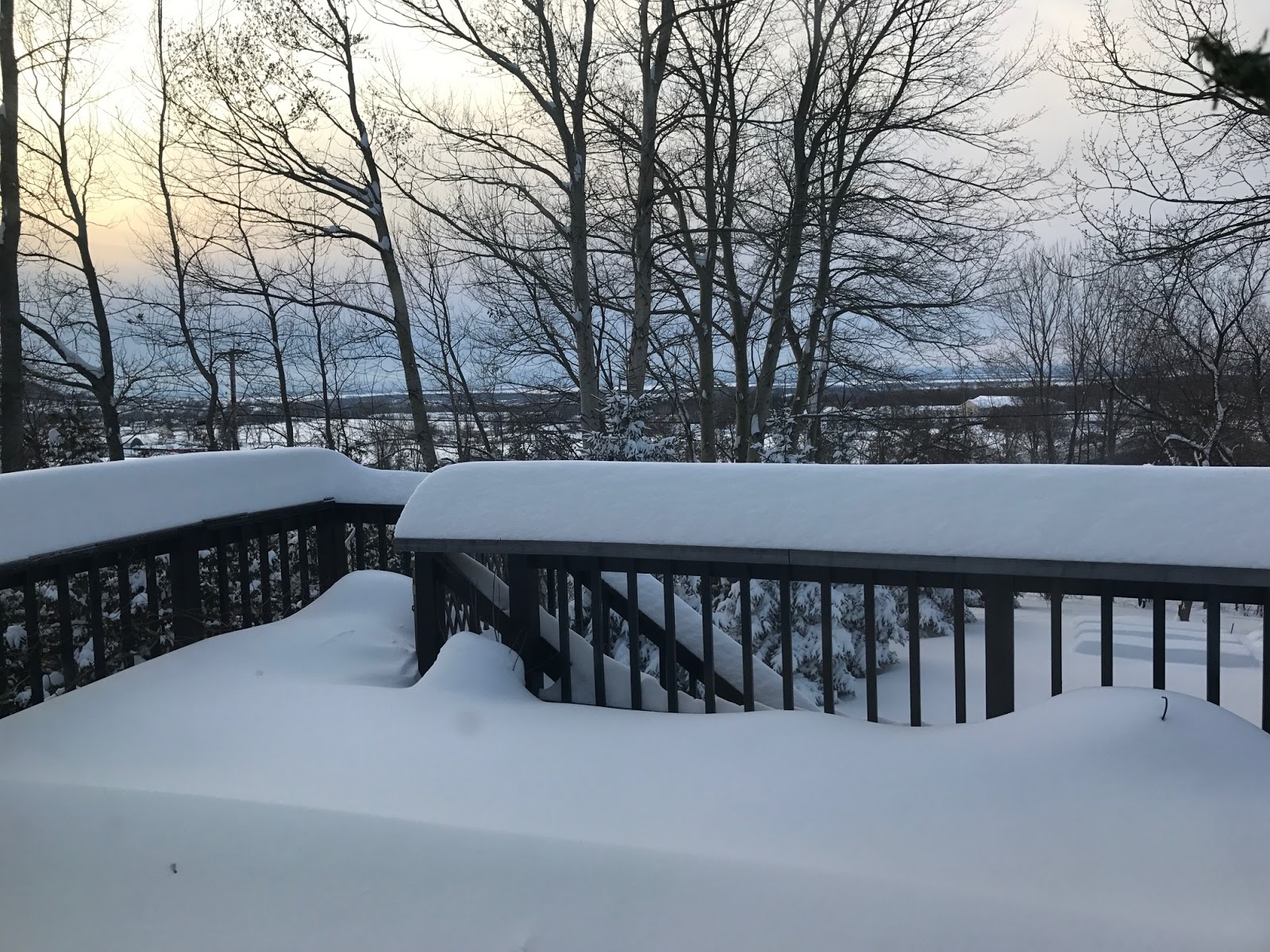
By the way, this rain has some implications for the prospect of spring flooding in Vermont. You will have noticed that the snow is much, much less deep than it was yesterday. The rain has settled the snow quite a lotl

With the rain falling on compacted snow and cold ground, our
St. Albans, Vermont driveway is now a skating rink. 
But not much of it is actually melting. The rain is soaking into the snow, so that by the time we're done with this rain later today, the amount of water in the snow will have increased by quite a bit, as we're expecting at least a half inch of rain today. Most of that will become part of the snow pack.

This by no means whatsoever guarantees we will have or have worse than usual spring flooding. It just ups the chances of it a little.

What actually happens this spring depends on what the weather is like in February, March and at least the first part of April. If we keep getting snowfalls with not much thawing in February and early March, then an abrupt turn to warm, wet weather, that's a big problem.  Flooding would be likely.

If we don't get much snow for the rest of the winter, and/or the spring melting season is gradual, then there's not much to worry about.

The National Weather Service in South Burlington releases a hydrological outlook every other week during the winter and early spring predicting how much of a flood threat there is. The next outlook is due out today, but it was not available yet as of this writing.

By the way, I suspect the National Weather Service is having a harder time than usual getting measurements as to how much water is locked up in Vermont's snow pack. The government shutdown is probably interfering with data collection, making hydrologists' and meteorologists' jobs more difficult.

The last Vermont/New York hydrological outlook, issued January 10, said the threat of flooding was somewhat below normal, but that was before a series of snow and rain storms that hit the region over the past two weeks.

After today, no major thaws are likely for the next couple of weeks at least. We'll get more snow, as several systems seem poised to come through, but at this point, there's no indication of any enormous snowstorms.

TONIGHT'S FREEZE

The anticipated cold front today has been postponed a bit until later today, but it will go below freezing this evening amid some light snow. That water on the ground will freeze up, so it will be treacherous underfoot going forward over the next days and weeks.

With freezing conditions and some snow, road conditions probably won't be great this evening.

ARCTIC OUTBREAKS

The weather pattern over the next week or two will feature quick hitting outbreaks of Arctic cold with  brief periods of seasonably mild weather in between. It will be quite changeable around here.

Saturday looks bitter, with highs near 10 degrees, followed by a relatively mild Sunday, then a very cold Monday, followed by a milder Tuesday and on it goes.

Relatively weak weather systems will be swinging through during this time as well. Each of those will throw handfuls of winter snow down on us, but none of these little storms look like they will dump big amounts of snow on us.

There's already a lot of hype on weather geek social media about one of these Arctic outbreaks, set to come into the United States in about a week. This one at this point looks like it will be particularly harsh. 

What's good for us in Vermont is this Arctic outbreak will come across the Canadian border in the northern Plains and western Great Lakes, so they will get the worst sting from this. Temperatures across the Midwest could easily be the coldest in two or three years.

Despite the hype, this won't be the Worst Cold Wave Ever.  Some daily record lows will be set, but few reasonable forecasters are expecting historic cold. Dangerous, yes, but not the ultimate freeze out.

Early indications are by the time this cold wave hits Vermont, it will be worse than the one that hit a few days ago, but not as bad as the most intense cold waves we've ever had. We'll tease out the particulars of this bitter blast once it gets closer to the time when it is expected to hit.

Plus, this will be another Arctic shot that will last just a few days before temperatures moderate. There will be other Arctic blasts after that. But by then, we will be heading into February.

The worst Arctic cold waves tend to have a little less bite starting around the third week of February. So this won't last forever.

Wednesday, January 23, 2019

Wednesday Evening Vermont Update: Ice Is Late, But Still Coming

A familiar sight for me this winter. The road in front of my
house in St. Albans, Vermont was once again snow covered
and slippery today as more snow came through in
advance of some freezing rain scheduled for tonight. 
Vermont caught a bit of a break this afternoon, as most of the precipitation that did fall in the state came down as snow.  

First off, there wasn't all that much snow to report. There was steady snow for a few hours this afternoon in far northern Vermont. I picked up about 1.5 inches of snow today at my place in St. Albans.

Most of the rest of the state was mainly dry today, but that's changing as I write this at 5 p.m. Wednesday.

A good slug of precipitation is coming in from New York State. There will probably be some snow with this, especially north, but this is where the well-advertised icy mess comes in.

As of 5 p.m., it was still below freezing everywhere in Vermont except the far southwest corner around Bennington.

Which means nearly everywhere will get sleet and that dreaded freezing rain this evening. Many of us will continue to see the freezing rain at least until midnight, as temperatures slowly keep rising

As mentioned before, even after the temperatures creep above freezing, the rain will keep icing up on cold surfaces.

The weather forecast remains basically unchanged for Thursday with rain changing to snow from west to east during the afternoon. We'll get only a dusting to two inches, but that will be enough to make the roads slick again for the Thursday evening commute.

Forecast Unchanged For Messy, Icy Vermont Weather Today, Tonight

The regional weather map from the National Weather Service in
South Burlington, Vermont has us mostly in blue, which
means most of us are in a winter weather advisory for
icy conditions later today and tonight. 
As expected, it's a windy morning in Vermont's Champlain Valley as temperatures warm up in a south wind.

The temperature at 7 a.m. this morning in Burlington, Vermont was 24 degrees, a full 38 degrees warmer than at the same time on Tuesday morning.

But the amount of warming we're getting - about to get - has its limits, which is why the forecast for the next day or so remains decidely icy and gross.

Aside from a little light snow near the Canadian border this morning, it has been dry so far, but that will change.

Snow, sleet and freezing rain will move in this afternoon, and continue overnight. The snow will be confined to the onset of the precipitation today, and the end of it Thursday afternoon. Today's snowfall accumulation will amount to no more than a dusting, with perhaps one to two inches in the northern Green Mountains and Northeast Kingdom.

Obviously, snow isn't the problem today and tonight. The freezing rain and rain will be the issue.  West of the Green Mountains, I'm pretty confident that temperatures will get above freezing later this afternoon and stay that way overnight.  That won't solve our problems.

It will stay just barely above freezing. Which will keep it chilly enough so that rain falling on the ground left frigid by the recent subzero cold will freeze on contact. It will be miserable underfoot, that's for sure. Careful! Don't fall!

If you're driving home from work late this afternoon or this evening, be ready for some slippery driving. The salt shakers, as I call the Vermont highway department trucks, will be out. But it will be icy, especially if you're off the main roads.

This will be a particular mess in busy places like Burlington. The snow from the weekend storm isn't entire removed yet. It's still slushy, messy and snowy on the sidewalks and streets. As things ice up, it will be a major chore walking anywhere in the Queen City.

East of the Green Mountains, it will be a tossup as to whether the temperature will be just above or just below freezing overnight. The effect will be the same there, though. It will get very icy underfoot.

Where it does stay below freezing, forecasters still don't think the ice will accumulate enough to harm many trees or power lines, so there's that tiny silver lining.

Granted, all this is definitely not the end of the world for us winter-hardened Vermonters, but it's still a bit of a pain in the butt.

Thursday morning, temperatures might briefly soar into the 40s, especially west of the Greens, but a cold front will quickly come in. That will change the rain to snow from west to east during the day. That snow will be caused by a storm rippling northward along the cold front.

It won't amount to much. It looks like maybe a dusting to two inches in the valleys, with two to four inches possible in the mountains. Thursday snow will be enough to give us the second afternoon commute in a rowa that will have its winter challeges.

Everything will freeze solid again Thursday night.  As I said yesterday, it looks like the ice underfoot will be a long term problem, lasting many days to perhaps even a few weeks.

The weather pattern will stay active into early next week. There will be chances of some snow almost every day, but at this point, it doesn't look like there will be any blockbuster, huge storms.

That said, it's a complicated weather pattern coming up, so there could be some surprises.

If you're bummed about the weather forecast in Vermont for the next day or two, join the club. But as is so often the case so far this winter, southern New England is getting it even worse.

There will be little or no ice down there, at least until after things freeze back up Thursday night, but there are other issues.

That storm I mentioned that will move northward along tomorrow's cold front will probably unleash a lot of rain on southern New England. Between that and melting snow and ice in some areas, there could be some flooding. 

After a very wet 2018 in southern New England, that region is off to a very wet start in 2019. This January might be among the wettest on record in that region. (Here in Vermont, we've had more precipitation than normal, but it's not record-setting.)

Strong winds could hit coastal areas, too, on Thursday. Especially in areas that got the ice storm Sunday, that could bring down trees and power lines weakened by the storm a few days ago.

We're about halfway through meteorological winter, folks. It's all uphill from here. It will just take awhile.

Tuesday, January 22, 2019

Busy, Icy Vermont Weather Continues: An Update

Same view of my deck in St. Albans, Vermont that I posted this morning.
Only now, instead of clear, blue skies, you can see a high, thin overcast
The clouds are a harbinger of our next messy storm, due tomorrow
into Thursday. 
The busy weather pattern we've got in Vermont forces me to do another quick update this Tuesday evening

You probably noticed the high, thin clouds spreading over the sky late this afternoon, dimming the sun and heralding yet another storm.

As I mentioned this morning, the new storm tomorrow and Thursday   won't have any blockbuster accumulations, it will still create a real mess.

That's why there's now a winter weather advisory in effect for all of Vermont from 5 a.m. Wednesday to 1 a.m. Thursday. I think that advisory might also get extended later in eastern Vermont.

Snow will come into Vermont during the day Wednesday, and pretty quickly go over to  a mix of sleet and freezing rain. In the Champlain Valley, the freezing rain will change to a cold rain by mid-afternoon, but that won't help.

I'll repeat what I've said earlier: The ground is cold after that sub-zero spell, so even if the temperature is a little above freezing, rain will still ice up on the ground.

Worse, there's still a lot of compacted snow on roads, sidewalks and driveways. That rain will form a slick layer on top of that compacted snow and we'll have a real set of skating rinks on our hands. And that mess on the ground won't be as easy to get rid of with salt because it's so thick. This will continue to be a problem well after the storm is over Thursday night.

East of the Green Mountains, temperatures in most places will stay below freezing for most if not all of Wednesday night, so the freezing rain will continue.

In the Champlain Valley, strong winds from the south Wednesday will cause a lot more blowing and drifting snow before the freezing rain and warmer temperatures set in during the afternoon.

Driving conditions won't be great Wednesday morning, so take extra time to get to work. Coming home in the afternoon won't be a picnic, either, especially if you're outside the Champlain Valley. Even in the Champlain Valley, you'll want to watch it, especially if you're not on a main road.

Thursday the rain will change to snow as cold air comes in. The snow will be wet at first, then dry out. The snow won't amount to too much. Probably two inches or less.

As temperatures fall, all this mess on the ground, the driveway the sidewalks, etc will be even thicker in many places, and everywhere it will freeze hard and solid,

I think for most of the rest of the winter, hospital emergency rooms across Vermont will be busy treating lots of people who will have fallen on the ice.

This really is a rough winter, isn' t it?