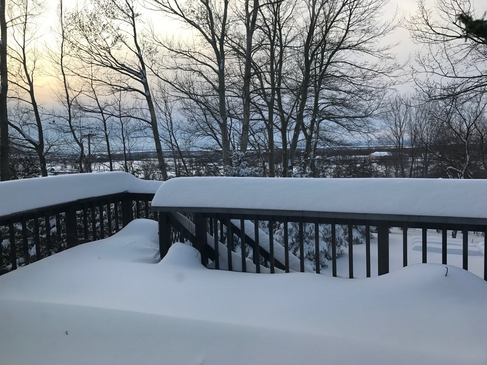
Showing posts with label winter weather advisory. Show all posts

Sunday, April 26, 2020

Spring Snow To (Temporarily) Crush Spring Hopes

A spring snowstorm in Burlington, Vermont back on April 27, 2010.
See? This kind of thing HAS happened before. 
It seems hard to believe, this late in the season, and after a really nice spring day on Saturday that brought sunshine and temperatures near 60, that much of Vermont is under a winter weather advisory for snow.  

But yep, much of Vermont is under a winter weather advisory.

It's a tricky forecast, so I'm anticipating some of the forecasted amounts of rain and snow with this system are going to off in some areas.

But I guarantee snow in at least part of Vermont and some flakes will probably make it down to valley floors in many locations, even perhaps the "tropical" Champlain Valley.

For snow die hards, some of the highest peaks, especially in central Vermont, could get buried. What I said yesterday about Killlington Peak probably managing a foot of new snow out of this still holds.

In lower elevations where most of us live, it won't be that bad. But still, a late April forecast that features a few to several inches of snow, the risk of slick roads and a few power outages, is not exactly encouraging.

The majority of Vermonters, I would say, live at elevations below 1,000 feet. In those spots, if any snow accumulates tonight, it'll be a slushy coating to an inch, which will melt on Monday despite continued chilly temperatures.

There is one interesting thing, tbough that the National Weather Service in South Burlington has picked up on. Some high resolution computer models have a particularly heavy band of precipitation setting up across central Vermont tonight.

Heavier precipitaiton will more likely be snow, so it's possible a narrow band in central or north central Vermont could pick up as much as half a foot or even more of snow. This is uncertain, but something to watch.

The higher you go above 1,000 feet, the more snow you'll get, especially in the southeastern ntwo thirds of Vermont. I'm guessing perhaps two to six inches will pile up in some areas above 1,500 feet in elevation.

The winter weather advisory (I'm sick of those three words at this point) cover all of Vermont except the Champlain Valley, lower elevations of Rutland county and the Connecticut River Valley from about Springfield south.

TRICKY FORECAST

There are a lot of complication to this forecast, as I mentioned above. The air to start this morning was very dry. Temperatures were able to get up to the low 50s by mid morning as a little sun was easily able to heat that dry air. Those will be the high temperatures for the day.

This sounds odd, but a warm front will create most of our snow risk.  The warm front, well to our south this morning, will strengthen as it moves north, but it won't ever quite make it through.

Precipitation will start to fall from the thickening clouds overhead early this afternoon.  At first, rain will evaporate on the way down as it encounters the dry air.

Eventually, as the air moistens, the rain will make it to the ground, and the temperature will fall as the rain continues. Eventually, tonight, it will cool off enough to change the rain to snow, starting at the highest elevations then working downhill.  When precipitation starts to fall especially heavily, that would pull more cold air down to the surface, encourage snowflakes to reach valleys, and create quick hits of one inch snow accumulation rates up high.

Another tricky thing is a dry high pressure system to the north. As the moisture comes in, the dry air to the north will battle it, possibly causing bits and pieces of that dry air to get mixed in with the flow of air north of the warm front.  That could cause the rain and snow to be spottier and more intermittant at times, especially along and north of Route 2.

The heaviest rain and snow will have passed by Vermont by early Monday morning. This storm is a slow mover, though, which is typical of spring storms. (The snow is unusual for this time of year, but the forward speed of the storm is not).

That means cold rain showers and high elevation snow showers will continue all day Monday, Monday night and into Tuesday. The rain and snow won't come down hard, and be mostly focused on the mountains, but the start of the week will be nasty for the closing days of April.

High temperatures both days will only be in the 40s, compared to normal temperatures near 60 degrees. On the vaguely bright side, nighttimes won't be nearly as cold in the coming days as that wintry blast we had last week.

Instead of teens and 20s for lows, temperatures will stay in the low to mid 30s tonight, Monday night and Tuesday night, though there will probably be some upper 20s showing up in colder spots Tuesday night.

OUTLOOK AND HISTORY

We get another brief break on Wednesday before the next storm lumbers in on Thursday and hangs around for a few days after that.  It still looks like that next storm will be mostly or exclusively a rainy one.  There is the potential for a lot of rain with that one. We'll have to wait and see.

The weather pattern continues to look on the cool side at least into the second week of May.  There will probably be a few warm or warm-ish days thrown in, too. And remember, normal temperatures keep rising, so the cool spells will keep getting less and less cool.

For the moment, at least, I'm not seeing signs of any more snowstorms after this one. I'm hoping we're done until  about Thanksgiving. Then it can snow again.

History doesn't always repeat itself, but I'll give a grain of hope for those longing for some hot summertime weather.

On May 9, 1977, a record late snowstorm struck New England, including much of Vermont. Up to 20 inches of snow fell on central Massachusetts, felling lots of trees that were already in full bloom. Parts of Vermont got more than six inches of snow.

Just eight days later, on May 17th that year, it was up to 90 degrees, and a few days after that, Burlington set its all time record high temperature for May of 93 degrees. (The record has since been tied).

In 2010, five to 12 inches of snow fell on parts of the Champlain Valley and northern Vermont on April 27-28. Five days later, temperatures were in the mid-80s.

That won't happen this year, but it is a sign that spring and summer will get here eventually.


Wednesday, January 15, 2020

Vermont Snow Tonight, Thursday Will Be Bigger Deal Than First Thought

The famous National Weather Service snow forecast map is back!
Northern areas will get the most snow out of the next system
tomorrow. Click on the map to make it bigger and easier to see.
Yesterday, I told you Vermont, after a long period of warmer than normal temperatures, is at the start of a snow cover rebuilding period.

That snow cover will come in with a bigger initial oomph than first thought, at least across a good portion of Vermont.

Some areas will get more than half a foot of snow, which is a start, anyway.

The storm coming in from the southwest overnight will be strengthening as it does so.  It's a pretty dynamic system, so by the time it gets here, it will have enough energy to give us a pretty good amount of snow.  

The system has a lot of "lift" to it.  That means it will really encourage air to rise over us as more, fairly moist air comes into replace it.  Rising air means moisture in that air condenses and fall as precipitation. In general, the better the lift the heavier the precipitation.

So, the bottom line is we have a pretty good slug of snow coming in. This won't be a blockbuster in the grand scheme of things, but it looks like its going to be a relatively nice dump, especially in the northern mountains.

Total accumulation might be as little as two inches in far southeastern Vermont, but most of us can expect three to five inches of snow, says the National Weather Service in South Burlington.

The northern Champlain Valley, say around St. Albans, much of the rest of Vermont north of Route 2 and the central and northern Green Mountains are in for at least six inches of snow.

Where the six inch plus totals are expected, a winter storm warning is up, going from 11 p.m. tonight to 7 p.m. Thursday.  For the rest of us, there's a winter weather advisory. 

The heaviest snow looks like it will come during the early and perhaps mid morning. So yeah, your morning commute is going to be tricky. Plan on that. Starting tomorrow morning and especially in the afternoon, the wind will really pick up, so there will be a lot of blowing and drifting snow to deal with.  You'll be dealing with that when you come home from work in the afternoon.

There won't be much snow falling in the valleys by afternoon, but the mountains and western slopes should continue to see some more accumulating snow.

Gusts will easily go over 30 mph, so you'll notice it. Temperatures will also be falling during the course of the day, setting us up for the coldest cold shot since mid-December, or maybe since last winter.

It'll get near or below zero Thursday night, not climb out of the single digits Friday afternoon, then go below zero again Friday night, with the coldest areas getting close to 15 below.

That's not unusual at all for a Vermont January, but since we haven't really seen anything like that this last winter, it might come as a bit of a shock.

It still looks like it will snow over the weekend, but at this point, it doesn't look huge. Maybe another moderate three to five incher, we'll see.

Another sharp Arctic spell will return early next week.

Monday, November 18, 2019

Two Very Different Problems With Ice In Vermont And Australia

The National Weather Service in South Burlington had adjusted its forecast
slightly and delayed the expected onset of freezing rain later today.
Click on the map to make it bigger and easier to see. In the Champlain
Valley, many of us have a shot of making it home from work before
the roads ice up.
There's some slightly good news in the forecast regarding the freezing rain and sleet that's expected to hit Vermont later today and tonight.  And at least we're not having other problems with destructive balls of ice like Australia had this weekend. (More on that further down, with videos).

Let's get into Vermont first. 

It looks like the onset of this icky precipitation will be a little later and a little lighter than first forecast. It looks like only spotty, very light freezing rain will hit in time for this afternoon's commute, especially west of the Green Mountains.

East of the Greens, it will be a little worse.

We're still going to get the ice, it's just coming later, mostly overnight.  Ice accumulations are still not expected to be whopping. The trees and power lines are pretty much safe. But anyone traveling tonight and overnight can expect really icy roads.  It'll be a good night to stay in and watch "Monday Night Football" or "The Voice" or whatever.

Tuesday morning still looks a little dicey if you're driving to work or school.  Overnight, freezing rain will transition to sleet then snow in most places. A little snow atop ice is never a good thing, so be careful!  All of Vermont and pretty much all of New England is under a winter weather advisory for this icky weather.

We Vermonters catch another break of sorts Wednesday and Thursday.  There will be little if any precipitation. Temperatures will remain colder than normal, but not nearly as far below normal as it's been lately. At least no more record lows are anticipated this week. We'll take what we can get.

The next weather maker is coming along Friday.  It looks like it might be a rain to snow situation, but precipitation won't be super heavy, as it seems now. Stay tuned for updates on that one.

AUSTRALIA HAIL

Large parts of Australia, including a good chunk of Queensland in the east, have been battling wildfires in recent weeks.
Hail damage after a big weekend hail storm in Queensland, Australia

Parts of Queensland got a decidedly suboptimal way to fight those fires over the weekend. Mother Nature decided to throw giant balls of ice at the flames.

Yep, Queensland got nailed by hail.  Big time.  The hail in some areas was the size of baseballs or even softballs. A large supercell thunderstorm was to blame.

The hail caused major damage to countless cars and windows in the area. The relatively brief storm managed to cost at least $40 million in damage, according to Australia's ABC News.

Here are some videos:

This car took a bit of a pounding, didn't it?


Few things are as noisy as big hail in a parking lot.  This is at some place called Aussie World. You can see the car windows getting smashed out during the video:


Some cool slo-mo of somebody releasing a lot of hail from fruit-catching nets in an orchard:


Friday, March 22, 2019

Vermont Snow Really Piling Up On Hills. Deeper Valleys Not So Much -- Yet

Not as much snow in many Vermont valleys as feared this morning,
but the snow is on the way. Updated National Weather Service
forecast map still shows more than six inches coming in the
yellow and orange areas, three to five inches, generally in
the blue. Snow accumulations still look really dependent on elevations
1 p.m. FRIDAY STORM UPDATE

So far today, the snowstorm is behaving largely as expected, although there are some picky details that are altering things a bit.

As expected, the lowest elevations are getting a rain/snow mix. Web cams in the Champlain Valley, for instance, show little if any accumulation.

Go up just a couple hundred feet in elevation, and it's sticking.

Run uphill another couple, or few hundred feet, and the snow is sticking to the roads. Web cams out of Berlin, Vermont showed a snow covered, slippery Interstate 89 at that relatively high elevation.

The web cams also show sagging trees under the weight of the heavy, wet snow, so it looks like power failures will be an increasing problem as we go through the day into tonight.  We were closing in on 3,000 outages or so as of shortly before 1 p.m. in Vermont.

Those outages will spread to new areas as it gets colder later today and this evening. Rain/snow mixes in the lowlands will change to all snow, and the trees and lines will get weighted down there, as well.

The National Weather Service in South Burlington added Washington and Caledonia counties to the winter storm warning, as more snow than expected seems to be coming down in those areas. Especially in the higher elevations.

There's already some relatively impressive snow totals out there so far in the mid and high elevations. By noon, Cabot had accumulated nine inches, and Middlesex had eight inches. Lots of places had two to five inches.

PREVIOUS DISCUSSION

Storms like the one currently harassing us Vermonters have a high bust potential, as noted yesterday, and here we go with that.

The good news for most of us who have to get to work is, this Friday morning isn't nearly as bad as we thought it would be last night.

Even so, the precipitation became heavier just in time for this morning's rush hour. Which the National Weather Service in South Burlington said would happen.

So road conditions did deteriorate as we were headed to work this morning. On my trip from St. Albans to Burlington at around 8 a.m., light rain had just changed to heavy wet snow, but the road wasn't snow or slush covered - yet.

The bad news (or more good news if you're a die-hard winter freak) is most of us still have a BUNCH of snow on the way.  Yes, even in the valleys.

Overnight and early this morning, it has been snowing in the mid and high elevations, while valleys have had a cold, light rain, or a mix of light, wet snow and rain.   As of 6 a.m. roads in the Champlai Valley were good, as temperatures hovered a few degrees above freezing. Elsewhere in Vermont, it depends on where you are. Roads are good to bad, depending on elevation.

The morning will continue with the mix of rain and snow, with all snow above 1,000 feet. You'll probably notice in the valleys that it will often be more likely rain when the precipitation is lighter, and snow when it gets heavier. That's the nature of the beast.

It now looks like the most "interesting" part of this storm comes in late this afternoon and tonight. The nor'easter will strengthen as it moves, well, northeastward into the Maine coast.

When this happens, there is often added lift, or rising motion in the air to the west of the storm. Rising air encourages precipitation, and we in Vermont will be west of the storm. So precipitation will start to come down more heavily later today. 

Wet snow falling in Winooski, Vermont this morning. It was warm
enough at the time that it was not sticking to the road.

At the same time, north winds will be strengthening as the storm deepens, and that will pull down some colder air from Canada. Everybody in Vermont and northern New York will transition to snow.

The mountains still look like they will get blasted. The western slopes of the Green Mountains, the summits, the Northeast Kingdom and parts of north-central Vermont north of Route 2 will get six to 12 inches, says the National Weather Service in South Burlington.  All of those spots are still under a winter storm warning until noon Saturday.

The Adirondacks and St. Lawrence Valley of New York can also expect six to 12 inches. Some mountainous areas look like they will get as much as a foot and a half of snow, especially in the High Peaks of the Adirondacks and the ski areas and highest elevations in the northern half of Vermont.

Lower elevations, like the Champlain and Connecticut River valleys and maybe deeper river valleys like right along the Winooski River, will get three to eight inches of snow, says the NWS. Again, this will be really dependent on elevation, with amounts rapidly increasing the more uphill you go. All these areas are still under a winter weather advisory. 

Winds will really pick up by tonight, so the wet snow and the wind will weigh down trees and power lines. Expect at least some power outages across the state overnight and Saturday morning. There could be quite a few outages, if things get bad.  Gusts will reach 40 mph in many spots. Roads will be lousy overnight and Saturday morning.

Remember, wet snow on roads is even more slippery than the powdery stuff. Slush is deceptive. It's almost always is worse than it looks.

The snow will become more and more confined to the western slopes of the Green Mountains and Adirondacks during Saturday morning then finally taper off.

Some sun will appear in many areas during Saturday afternoon, but like I said yesterday, so what, it will still be wintry. Temperatures will make it into the low 30s at best in most locations, and that stiff north wind will continue.

Sunday still looks better, but that next Arctic front looks like it's moving a little faster. Clouds will creep in across the north after a sunny start Sunday, and there might be a light rain shower toward the end of the day as temperatures briefly make it into the 40s.

Monday and Tuesday still look miserably wintry, windy and cold with subfreezing highs and lows in the unseasonable single numbers and low teens. A temporary warming trend still looks to arrive during the second half of the week, and that will melt some of the new snow, at least in the valleys.


Thursday, March 21, 2019

Thursday Evening Update: Fine Tuning Messy Vermont Winter Storm Forecast

The National Weather Service in South Burlington updated
their snow forecast map this afternoon. More of the area would
get more than six inches of snow than in the earlier map.
(Yellow is six inches of more. Dark orange and red is over a foot.
Click on the map to make it bigger and easier to see. 
The National Weather Service in South Burlington, and surrounding NWS offices, have spent this cloudy Thursday afternoon fine-tuning their forecasts for this messy winter storm that's coming in later tonight. It will last into Saturday, with a lull of sorts Friday afternoon.

(Pardon any typos: I had to crank this one out fast because of a busy evening schedule.)

What follows is how the National Weather Service thinks this will play out. But remember, temperatures are marginal, so there is still a bust potential.

There might be more snow than expected, or less, depending upon if the temperature during much of this thing is a degree or two warmer or colder than expected.

The nor'easter was soaking New Jersey, Pennsylvania, Maryland and environs with a soaking, flood-threat rain late this afternoon. The leading edge of the precipitation was also approaching southern Vermont around 4 p.m. today.

The precipitation will overspread the area tonight, and that's when it gets tricky. It'll be snow in the upper elevations. With that in mind, there's a winter storm warning for the entire Green Mountain chain, the Northeast Kingdom, parts of north-central Vermont and the Adirondacks.

Snow there late tonight and early Friday will come down hard, and the roads will get very nasty very fast. Elsewhere, it looks like a rain/snow mix, trending to snow in many areas early Friday morning.

When the precipitation comes down the hardest early Friday, that's when the first half of this one-two punch storm will most likely bring snow, even in the Champlain Valley. It's unclear if it will go to all snow or a mix everywhere in the Champlain Valley, but I'm thinking at least some accumulationg snow.

To be safe, expect a tricky Friday morning commute pretty much everywhere. Wouldn't you know, the worst and heaviest snow looks like it wants to come through perfectly for the morning commute.

There is a winter weather advisory for the valleys late tonight through Saturday to cover the periods of snow.

It looks like there will be something of a lull in the precipitation during the later morning and afternoon Friday. There still will be light rain and snow around. Some areas that will have had a burst of snow early Friday will go over to light rain, but the higher elevations will stay snow.

A second moderate to locally heavy precipitation will come in after dark Friday night and continue into Saturday. The mountains will continue to pick up snow. Pretty much everybody that will see some rain Friday will go over to snow.

As it looks now - again this could easily change - another one to three inches of snow could accumulate in the Champlain Valley with much more the higher up you go.  If you can postpone travel plans until Saturday afternoon, do that.

Total accumulations look like they will be really impressive in the northern and central Adirondacks with 12 to 18 inches expected. The high elevations of the Green Mountains, especialluy north, look to have something similar.

Mid elevations, including places like Montpelier, Barre, Morrisville and the valley floor in Stowe could get as much as four to eight inches out of this storm. The Champlain Valley perhaps will get two to six inches total, the most north toward St. Albans.

Much of this snow will be wet, and strong winds will develop, so there remains a risk of power failures with this.

Snow will taper off Saturday and some sun might break out in the mid and late afternoon. Don't expect much melting, though as temperatures stay at or below freezing for most of us with a gusty cold northwest wind.

Sunday looks awesome for winter sports with that fresh, deep snow cover in the mountains. Highs then will reach the 40s in the valleys and 30s in the mountains under sunny skies.

It still looks like more snow showers, then mid-winter cold Monday and Tuesday - highs below freezing again for most of us. A warming trend looks like it might start midweek. Fingers crossed!

Thursday, February 7, 2019

Freezing Rain Turned Vermont Into An Icy Disaster Last Night; More Ice Nightmares Today

Pedestrians walk gingerly on a very icy sidewalk in downtown
Burlington, Vermont during Wednesday evening's ice storm. 
Well, that was a nightmare.

Last evening, freezing rain moved into Vermont just in time for rush hour, and it came with more of a vengeance than almost anyone expected. The result was one of the worst Champlain Valley traffic nightmares I can remember in the more than 30 years I've lived in this region.

As of mid-morning this Thurdsay, it's not quite as bad as it was last evening, but untreated roads, sidewalks and driveways are still a nightmare.

This evening's commute could be another real headache. I'll get into this more in a minute further down, and you'll want to read it. There's still some icy danger on the Vermont roads now, through the day into tonight.

First, let's go chronological order and unpack what happened Wednesday evening.

We knew freezing rain was a risk well ahead of the onset of Wednesday's storm. That's why winter weather advisories were up ahead of the mess for all of Vermont except the areas along the Canadian border.  That winter weather advisory did include Burlington, which was the epicenter of Wednesday evening's

Starting Tuesday evening if not before, everyone was being advised that the Wednesday evening commute would probably be tricky. But it turned out to be a lot trickier than almost everyone, including me, imagined.

The first problem was there was the idea, especially in the northern half of Vermont, that the freezing rain would be mixed with, sleet or snow. Or even that the sleet and snow would predominate. The added sleet and snow - though dangerous -  would give you more traction on the road that just freezing rain alone.
Ice glistens in trees and glares off  the pavement on Main Street in
 downtown Burlington, Vermont during Wednesday evening's ice storm.

Instead, there was almost no snow or sleet. Virtually all the precipitation right up to and past the Canadian border was freezing rain. At the onset, the National Weather Service hastily extended the winter weather advisory all the way up to the Canadian border.

Especially in the northern half of Vermont, the precipitation was forecast to come down quite lightly. Instead, there was a burst of freezing rain that came down fairly heavily.

Burlington reported 0.34 inches of precipitation. Not huge, but more than enough to create havoc. The main band of freezing rain only lasted four hours or so, but the timing was terrible.

The freezing rain moved in right at rush hour. And it went from a sprinkle to a serious drenching very quickly. I was traveling between St. Albans and Burlington at the time on Interstate 89, and I drove into the onrushing band of freezing rain.

In Georgia, everything was fine. By the time I hit Milton, it was pure smooth ice. Figure skater Michelle Kwan would have approved of the ice conditions for her routine.

Temperatures were only in the mid-20s at the onset of the freezing rain. It wasn't even close to 32, which meant the rain froze fast and hard.  I was driving on Interstate 89 in Colchester on a slight decline. My truck brakes were totally ineffective. I only avoided hitting the car in front of me by steering into the breakdown lane and gaining traction on the rumble strip.

Everybody else was having the same problem. Soon, people did start hitting each other. There was a 13-car pile up in Richmond.  Other crashes occured on Interstate 89 and near the Lamoille River bridge between Milton and Georgia.

Plus, a lot of people couldn't make it the slightest hill. Soon, Interstate 89 and every other road in the region was pretty much gridlocked.

With all the cars backed up, the salt trucks couldn't even get through the traffic to salt the roads. People were reportedly trapped in their cars on Interstate 89 northbound for two hours or more. A half hour commute for some people streched to nearly four hours.

Finally, later in the evening, Vermont State Police and other agencies were able to herd Interstate traffic into breakdown lanes so that the salt trucks could get through.

Things temporarily got better late at night, around 10 or 11 p.m. When liquid water freezes on contact, it releases a bit of latent heat. That, combined with a weak south wind, warmed things up so many parts of the Champlain Valley rose just above freezing. Some of the ice melted off the roads.

On the way back to St. Albans at 10:30 to 11 p.m. or so last night, there were still several cars abandoned in the breakdown lanes of Interstate 89. Rest areas were jammed with tractor trailer trucks, whose drivers wisely decided to give up on moving until things improved.

Trees were also weighed down by the ice last night, , but the brief thaw melted the ice off, so additional freezing drizzle today won't increase the danger of broken tree branches and power lines - except in a very few areas where it didn't get above freezing.

The only way to keep an ice storm going is if you get fresh supplies of cold air to overcome the latent heat release from rain freezing on contact. To do that, you'll need a steady, if light flow from the north. That's why the famous ice storm of 1998 lasted for three days. We kept getting a fresh supply of cold air.  

Which leads us to this morning, and the not-at-all-good situation out there now.

TODAY AND TONIGHT'S ICE SITUATION
My St. Albans, Vermont driveway is a skating rink this
morning after last night's freezing rain. This morning's freezing
drizzle and freezing fog is NOT helping. 

In the wake of last night's disturbance, a flow of north winds is funneling down the Champlain Valley this morning. It's below freezing in most locations, especially the Champlain Valley.

This is a repeat of what happened Monday, only worse because temperatures are lower and the subfreezing temperatures extend through the valley, not just the northern tip.

There's ice covering untreated roads and sidewalks and driveways. I simply cannot walk on my driveway. Luckily, I have a supply of sand that I will apply after I write this. There's patchy freezing drizzle and freezing fog around. I'd still be careful if you venture out today.

As it stands now, it looks like the Champlain Valley, especially the northern half, will stay below freezing all day. The rest of the North Country will hover near 32 degrees for the rest of the day.

Which leads us to the next storm this evening. The National Weather Service in South Burlington has already issued a winter weather advisory for areas outside the Champlain Valley. That's because this next storm is also bringing rain. With temperatures near 32, freezing rain is likely to coat roads again.

Initially, it was thought the Champlain Valley would stay warmer than it currently is, so there was no winter weather advisory. However the NWS in South Burlington, as of 10 a.m. this morning, was re-evaluating this. Given the cold north flow, the onset of precipitation this evening will probably be in the form of freezing rain in much of the Champlain Valley.

The only saving grace is the rain looks like it will start a little later than it did last evening, which means more people will have arrived home from work before the mess starts than last night.

Tonight, again, will be much like Monday night. Overnight, the winds from the south will really pick up, so after midnight, anything that comes out of the sky will be non-frozen rain. The last places to end the icing will be the protected valleys of north central and northeastern Vermont.

Then, another rinse and repeat. Just like Tuesday, Friday morning will be warm - in the 40s. That, I hope, would melt some of the accumulated ice out there Then, like Tuesday, temperatures will fall in the afternoon, and be below freezing by evening. Which of course means there will be more ice underfoot.

Enjoy!

Tuesday, January 22, 2019

Busy, Icy Vermont Weather Continues: An Update

Same view of my deck in St. Albans, Vermont that I posted this morning.
Only now, instead of clear, blue skies, you can see a high, thin overcast
The clouds are a harbinger of our next messy storm, due tomorrow
into Thursday. 
The busy weather pattern we've got in Vermont forces me to do another quick update this Tuesday evening

You probably noticed the high, thin clouds spreading over the sky late this afternoon, dimming the sun and heralding yet another storm.

As I mentioned this morning, the new storm tomorrow and Thursday   won't have any blockbuster accumulations, it will still create a real mess.

That's why there's now a winter weather advisory in effect for all of Vermont from 5 a.m. Wednesday to 1 a.m. Thursday. I think that advisory might also get extended later in eastern Vermont.

Snow will come into Vermont during the day Wednesday, and pretty quickly go over to  a mix of sleet and freezing rain. In the Champlain Valley, the freezing rain will change to a cold rain by mid-afternoon, but that won't help.

I'll repeat what I've said earlier: The ground is cold after that sub-zero spell, so even if the temperature is a little above freezing, rain will still ice up on the ground.

Worse, there's still a lot of compacted snow on roads, sidewalks and driveways. That rain will form a slick layer on top of that compacted snow and we'll have a real set of skating rinks on our hands. And that mess on the ground won't be as easy to get rid of with salt because it's so thick. This will continue to be a problem well after the storm is over Thursday night.

East of the Green Mountains, temperatures in most places will stay below freezing for most if not all of Wednesday night, so the freezing rain will continue.

In the Champlain Valley, strong winds from the south Wednesday will cause a lot more blowing and drifting snow before the freezing rain and warmer temperatures set in during the afternoon.

Driving conditions won't be great Wednesday morning, so take extra time to get to work. Coming home in the afternoon won't be a picnic, either, especially if you're outside the Champlain Valley. Even in the Champlain Valley, you'll want to watch it, especially if you're not on a main road.

Thursday the rain will change to snow as cold air comes in. The snow will be wet at first, then dry out. The snow won't amount to too much. Probably two inches or less.

As temperatures fall, all this mess on the ground, the driveway the sidewalks, etc will be even thicker in many places, and everywhere it will freeze hard and solid,

I think for most of the rest of the winter, hospital emergency rooms across Vermont will be busy treating lots of people who will have fallen on the ice.

This really is a rough winter, isn' t it?

Saturday, April 14, 2018

Saturday Evening Update: A Truly Winter, Not Spring Snowfall In Vermont

Traffic makes its way slowly along Riverside Avenue in Burlington,
Vermont amid a good dose of a very cold snow and sleet mix
late this Saturday afternoon. 
I am stunned by how cold it has gotten, especially in the northern half of Vermont as the next wave of wintry precipitation entered the region.

I knew the cold would be intense for this time of year, but it's even worse than I imagined, and worse than many forecasts indicated.

During the mid-afternoon, temperatures across northern Vermont were in the mid to upper 20s, pretty typical for that time of day in January. This time of year, it should be in the low 50s.

Temperatures dropped further this evening. At 6 p.m. it was just 24 degrees in Burlington. It was down to 19 degrees at Newport, Vermont and Saranac Lake, New York. Highgate, Vermont was just 22 degrees.

These are near record lows. Record lows should happen around dawn, not late afternoon. Just incredible!

By the way, the temperature contrast across the Northeast is almost unprecedented, too. At 6 p.m., while the temperature hovered around 20 degrees in far northern Vermont, it was in the low 80s in central New Jersey.

The result of the intense cold over northern Vermont has been a storm that feels like the first major Green Mountain State winter storm of the season in early to mid-December, not some oddball   snowfall in April.

Driving home on icy roads from Burlington, this evening, the relatively dry snow and some sleet, covered the landscape with about an inch of snow as of 6 p.m. Dead grass poked up through the snow, since it's been too cold for springtime stuff to grow. Bare trees and lousy visibility completed the look.

A photo of this looks exactly like that opening salvo of winter. Almost all other times, if we do get an April snowstorm, it's wet and heavy, and looks pretty temporary. This evening's snow and sleet has the feel that it will last on the ground for months, though I assure you it will melt soon.

Roads were terrible across northern Vermont late this afternoon. They got that way a few hours before anybody expected, since temperatures had been forecast to be a few degrees warmer.
A midwinter scene on Interstate 89 in Georgia, Vermonty late
Saturday afternoon. Too bad the photo was taken on April 14,
not the middle of winter. 

The snow and sleet will focus itself mainly along and north of Route 2, especially during the first part of the night.

Precipitation will sink south, as will the cold air overnight, so southern Vermont is in for freezing rain, sleet and maybe some snow.

This should continue into early Sunday morning. Northern Vermont is still expected to get three to five inches of snow and sleet, with the most being up near St. Albans, and up by Jay Peak, and far northern New York.

There will be little ice accumulation across the far north, but up to a quarter inch of in central and southern Vermont.

The snow and sleet is a major bummer for April across northern Vermont, far northern New York and New Hampshire, of course. But much heavier freezing rain is and will fall further west toward Buffalo, New York and Toronto, Canada.

There, we'll see lots of damage to trees and power lines. The northern Vermont precipitation isn't really sticking to trees and wires much, so at least through tonight, don't expect a ton of trouble with electric power. DO expect lots of trouble with icy roads.

The precipitation will become spottier for a time on Sunday, and transition away from snow and be more of a freezing rain, freezing drizzle, light sleet scenario.

There will be more trouble with freezing rain in some areas Sunday night, followed by steadier, heavier rain into Monday, possible flooding and likely wind damage along the western slopes of the Green Mountains.

Much more on that tomorrow morning.

Friday, April 13, 2018

Winter In April (Continued) For Vermont; Winter Weather Advisories Posted

Temperatures on Thursday were actually near normal for a change, and we managed to get through an entire storm system last night. (albeit a fairly weak one) with just rain, and no wintry precipitation.

But, as anticipated, your luck is about to run out again.

As advertised for days, that strong storm has set up in the middle of the nation and is in the process of forming that wet weather front near us through the weekend.

Strong Arctic high pressure in Canada will ensure plenty of cold air, so we in Vermont and much of the rest of the North Country can expect another winter storm this weekend.

Yeah, I know it's the middle of April, but ugh.

One change from previous forecasts is at least on Saturday and Saturday night, we can expect a lot more snow and somewhat less freezing rain than originally forecast.

Now the caveat: This is still a very, very tricky weather forecast, so I don't imagine things will go exactly as I'm about to outline. But the following is at least broadbrush, the current thinking of the National Weather Service in South Burlington, Vermont, and other meteorologists.

The cold air pushing in tonight and tomorrow is coming in with even more force than originally thought, which means the entire atmosphere over us will be cold, not just near the surface. Had there been more warm air aloft, we'd get freezing rain. Since the entire atmosphere will be cold, we'll have more snow.
Preliminary ice accumulation forecast from the National Weather
Service in South Burlington. Areas in red could see a
quarter inch of ice, which begins to risk tree, powerline damage.

You'll wake up to wintry conditions Saturday morning with sleet, freezing rain and snow.

In the south, the day will start with plain rain but go over to mixed precipitation pretty quickly.

Afternoon temperatures will be down in the low 30s in the south, and upper 20s in the north. For an afternoon, those are typical readings for mid-February, not mid-April.

Ugh again!

The general thinking is north of Route 2, we'll get three to five inches of snow and sleet, with just a thin glaze of freezing rain through Saturday night.

The cold push is now looking to be strong enough to push the weather front well south, far enough down that I wouldn't be surprised if the snow and sleet stops and skies just remain cloudy in north of Burlington and St Johnsbury for much of the overnight Saturday night.

Further south, like in the southern Adirondacks, and southern Vermont, there will be more freezing rain, with up to a quarter inch of ice expected. Although surprises are possible, I think snow will amount to two inches or less from central Vermont south.

That's enough to cause the risk of some tree damage and power outages, but not enough to be a disaster like January, 1998. But we'll have to watch this, because some areas are in for more freezing rain on Sunday.

The weather front that will have been suppressed by the cold air from Canada pretty well south of us will start moving back north Sunday as the main, strong parent storm comes closer from the Midwest.

However, the cold air from Canada will put up a huge fight on Sunday and only very, very grudgingly relax its grip. So the new surge of wet air from the south going up and over the cold air here will produce another round of sleet and freezing rain. Some snowfall might start the day, but the thinking is Sunday will be more icy.

I worry about some more tree and power line damage Sunday from ice, but that prospect is still iffy. The precipitation probably won't come down super heavily Sunday, which would be a good thing. Still, it's going to be another thoroughly miserable April day.

Very, very slowly, temperatures will sneak above freezing from south to north Sunday afternoon and night. But the freezing rain might keep going well into the night east of the Green Mountains.

Monday, the worst of the cold air will finally get scoured out by strengthening south winds, though temperatures will only get up to around normal - 50 ish or so.

The problem Monday is, after all the snow and ice and ick Saturday and Sunday, the rain will come down pretty hard, especially during the day and early at night. The combination of all that rain, all that snow and ice melting and warming temperatures will mean quite a bit of runoff.

I think at least minor flooding along a lot of rivers in Vermont, New York and elsewhere in the North Country is a good bet Monday into Tuesday.  It could even be more than minor and cause more road closures, flooded basements, etc. than usual. This won't be a Hurricane-Irene type flood disaster, but it's certainly something to take seriously.

I'm pretty sure the National Weather Service will issue a flood watch eventually, but right now they're focusing correctly on the winter weather that will come first.

They're still looking at the possibility of high winds on Monday too, just to add more "joy" to this lousy storm/.

After all that, the weather will remain - heavy sigh - unsettled and colder than normal next week

MISERY REST OF NATION, TOO

As expected, fast moving wildfires broke out yesterday in New Mexico, Texas and Oklahoma.

In northwestern Oklahoma, there were multiple fires, one with a fire front nearly 20 miles long. Dozens of people were evacuated ahead of the flames near Woodward, and reports are at least 20 structures were destroyed in the flames.

The fire risk remains very high today, especially in western Texas and southeastern New Mexico.

Farther north, the blizzard is winding up in the northern and central plains, with South Dakota, much of Nebraska, northwestern Kansas and southern Minnesota most under the gun.

Just ahead of the oncoming blizzard, some thunderstorms producing hail were harassing parts of eastern South Dakota this morning.

This is still expected to be a near record storm with up to 18 inches of new snow propelled by wind gusts of more than 50 mph. You'd be the ultimate fool if you tried to travel through the blizzard zone today through Saturday.

South and east of the blizzard, severe storms and tornadoes still seem like a good bet later today and tonight. Arkansas and parts of the adjacent states surrounding Arkansas seem to be under the greatest threat.

Monday, December 11, 2017

Moderate Sized Snowstorm Due In Vermont, New England Tuesday

Here's what the National Weather Service in
South Burlington is currently expecting for snowfall
through Wednedsay. Click on the image to make
it bigger and easier to see.
As of early Monday morning, we're still on track for a mid-sized snowfall Tuesday and Wednesday here in Vermont, so we'll have to deal with the usual wintertime slick roads, snow shoveling, and playing in the fluff.

You knew this would come eventually.

Before we get into Tuesday's main event, note that it is snowing in much of northern Vermont and New York this morning. Accumulations in most spots are around an inch, locally more in the mountains. It's enough to make the roads slippery, so give yourself extra time going to work today.

You'll need to do the same tomorrow. This storm is an Alberta clipper, coming in from the west. Usually, these clippers are not that big a deal. They usually toss one or two inches of snow on us and then move on quickly.

This one, however, has got more oomph than most of them, and its track is just perfect for a good dose of snow in northern New York, the northern half of New England and southern Quebec.

There's actually going to be two waves of snow. The first, on Tuesday, will pretty much affect all of us with a general three to seven inches of snow, with maybe a bit more than that on some of the eastern slopes of the southern and central Green Mountains.

A lull in the snow will probably come later Tuesday afternoon or the first half of Tuesday night as the storm goes by. But then the storm will consolidate and start to intensify fast just to our east. That will throw snow back our way.

It'll mostly affect the Green Mountains of Vermont on Wednesday, and also slam northern New Hampshire and much of Maine with quite a bit of snow, too. As the storm gets strong, northwest winds will pick up. Gusts Wednesday will reach at least 30 mph, which is more than enough to cause quite a bit of blowing and drifting. I guess Wednesday's commute is going to be annoying, too.

The bottom line: Most valley dwellers in Vermont can expect a total of three to eight inches of snow through Wednesday. That's where a winter weather advisory is posted. Those of you who live on the western slopes of the Green Mountains or in the Green Mountains can expect six to 12 inches through Wednesday. Those areas are under a winter storm warning through most of Wednesday.

It looks like the St. Lawrence Valley of New York, parts of New Hampshire and a good chunk of Maine will also see a good six to 12 inches of snow out of this one.

Thursday will be the coldest day of the winter so far, with daytime temperatures in many areas staying in the teens, with lows flirting with 0 Friday night. Temperatures will moderate into the weekend.

Wednesday, February 15, 2017

More New England Weather Drama New England Today-Thursday

This is what the National Weather Service in
South Burlington, Vermont thinks snow
totals will end up at with the storm moving 'in today.
Click on the image to make it bigger and easier to see.
A quick post today as I'm on a trip, but as you might have heard, we're in for more weather drama in the North Country.

Today,  Vermont's weather could be particularly interesting. A stong storm in the upper atmosphere is going to come across from New York and through northern New England.

During the day tonight, conditions will be sort of like those humid summer days with scattered strong thunderstorms. Only with snow and cold.

Huh?!?

Winter precipitation in New England is usually what we call stratiform. It's usually broad , pretty long-lasting areas of snow or rain or a mix that give us most of our moisture in the cold months.

In the summer, instability is stronger, so you get bands of downpours with thunderstorms that usually don't last long in any one place.

Today, the system coming out of the west is so dynamic that we're going to bet almost summer -like instablity up in Vermont.

That will produce lots of snow squalls. Some will be brief and drop only a dusting or so or snow. Some will be intense, or several might hit the same area over and over. dropping up to four inches of snow in a very short period of time.

A few of these snow squalls might even have thunder. Yep, thundersnowstorms are possible today.  So yeah, summer variety thunderstorms with snow.

It's hard to pin down in advance who will get the most intense snow squalls today, but expect rapid changes in the weather - and rapid changes in road condtions- at any time today.

This strong system will transfer its energy to off the Maine coast to generate another big nor'easter.

The snow will change to a more traditinal winter form this evening and tonight and into Thursday morning. It will come down steadily, and probably fairly heavily at times over the mountains and parts of the North. '

ACCUMULATIONS:

Let's look at the bottom line, then. Who gets what amount of new snow:

As the National Weather Service in South Burlington sees it, the immediate shores of Lake Champlain, and the low elevations of southern Vermont can expect three or four inches.

Areas a bit inland from the lake will get more. Pretty much anybody along and east of Interstate 89 from Burlington to the Canadian border can probably expect a good six inches of snow, or maybe a little more in spots.

Six to eight inches of snow are likely in most valleys across northern and central Vermont, in fact.

Just in time for the Washington Birthday weekend, and after already getting clobbered by snow early this week, the mountains of central and northern Vermont are going to be the big winners with this one.

Those areas can expect at least eight to 12 inches of fresh powder, with locally more in spots. (Watch Jay Peak: This storm is really designed to bury the slopes of that mountain.) The entire Northeast Kingdom of Vermont can expect eight to 12 inches of new snow as well, as they'll be closest to that developing nor'easter.

Very roughtly, everything north and east of Interstate 89 is under a winter storm warning and areas south and west of the Interstate are under a somewhat less dire winter weather advisory.

This is a weird weather system, so expect some predictions to turn out to be off-kilter in some locations.

New Hampshire and Maine are going to get totally nailed by this storm too.

Parts of New Hampshire and Maine that have received up to three feet of snow in the past week can expect 10 to 15 inches more today through Thursday. 

It's gotten so extreme in those areas that there is real concern we're going to get some roof collapses over the next few days in New Hampshire and Maine, especially since the storm now coming in is going to feature snow that's fairly wet and heavy.

Those of you who can get to the mountains this weekend ought to go. It's going to be perfect. The weather will turn quiet and warm, with highs in the 20s Friday and 30s over the weekend (a little cooler than that in the high elevations.)

Low elevations will see some daily thawing Sunday through Tuesday, but it will take quite awhile to get rid of this much snow.

Tuesday, March 1, 2016

March Arrives In Vermont Like A Lion, But A Mediocre One

Here's the National Weather Service office
in Burlington's projection for amounts of
snow we'll get with the storm late tonight
and Wednesday. Click on the image to make
it bigger and easier to read.  
5 p.m. TUESDAY UPDATE:

Storm seems to be trending a little north and west, which means a little more warm air creeping into the region.

That means somewhat less snow and more mix and rain across Vermont and northern New York.

The storm could still surprise us, but it looks like an inital burst of snow will drop 2 to 4 inches north and west, with less south and east.

There will probably be a tenth of an inch of ice or less.

The snow will start late tonight, and the changeover to ice and rain will begin before dawn for most of us.

I still expect a nasty commute into work tomorrow.

Rest of the forecast is unchanged. Temperatures will peak tomorrow morning and fall off in the afternoon. Any mixed precipitation will turn to snow and snow showers in the afternoon with not all that much accumulation.

Cold wave is still expected Thursday and Friday.


PREVIOUS DISCUSSION:

We in Vermont ended the warmest meteorological winter on record yesterday with a record-tying 50 degree Leap Day high in Burlington, but the beginning of March has much more wintry plans for us.

I'll have more on the record hot winter in a subsequent post later today.

Yeah, March is coming in like the cliche lion, but on the bright side, it won't be the most ferocious animal we've ever seen.

You probably heard winter's last minute stab at an attack last night as a cold front arrived with nasty gusts of wind. It reached 59 mph near Warren and up to 58 mph at Bolton late last night.

Those gusty winds cut power to about 18,000 homes and businesses in Vermont, according to Green Mountain Power. Most areas have had power restored by late morning.

The wind has calmed down, but it's cold out.  It's only around 10 degrees this morning and will only make it into the 20s this afternoon. That's a good ten degrees colder than average for this time of year.

Also it's pretty clear and sunny. Which means you have no weather excuse to blow off Town Meeting Day today. Grab your coats and go!!!

The real nasty weather comes in late tonight, well after the polls close.

Yet another fairly strong storm is coming and the center of it looks as if it will go right over Vermont.

That means, once again, we'll have an ugly mix of weather. Since the storm is going overhead and not to our west, we won't get as much plain rain out of this but more snow and ice, especially the further north and west you go.

Up in New York's St. Lawrence Valley, it'll stay mostly snow, so they'll get a good six to 10 inches out of this, as it looks now

Forecasting amounts of snow and ice is always tricky when you're right in the transition zone between snow, ice and rain, so there's a big bust potential.

Just know that it will be snowy and icy and slushy and icky by the time you get up Wednesday morning. You'll need extra time to get to work. A winter weather advisory is definitely in effect late tonight and Wednesday.

At this point, the National Weather Service is going with four to six inches of snow, plus some ice, north and west of a line roughly from Burlington to Newport.

Yeah, it's going to snow in Vermont, but it won't be
nearly as bad as this scene in high elevation
Crissolo, Italy this week.  
A broad southwest to northeast zone in central Vermont can expect two to four inches of snow, some ice, and a brief interval of plain rain in the middle of the storm Wedneday afternoon.

The southeastern third of Vermont will probably get only one to three inches of snow and slush out of this and a fair amount of rain.

By the way, we'll continue with our out of sync temperature trends. It'll gradually get warmer overnight, with temperatures peaking Wednesday morning. Then during the afternoon it will turn colder again, as the storm begins to pull away to the Northeast.

I said this is a fairly strong storm, but it's nothing like last week's powerhouse that brought record amounts of precipitation and flooding. This one will be fairly impressive, but not extreme.

Still the storm will be strong enough to produce some severe thunderstorms and maybe a tornado or two along the Gulf Coast and Tennessee Valley areas, but the dangerous weather won't be nearly as widespread as last week. Also, unlike last week, there won't be any severe thunderstorms in the Northeast, and I highly doubt there will be any thunder and lightning in Vermont.

Winter isn't done with us yet after the storm pulls away. We're in for what by March standards is a pretty impressive cold wave on Thursday and Friday. Nighttime temperatures will get below zero in  many places in Vermont, and daytime highs will struggle into the teens.

That's very cold for early March, but not record setting. We've seen worse.

For those who don't like winter, despite the fact we didn't really  have one this year, there's hope. A gradual warming trend will start Saturday, and by Monday, afternoon temperatures will be well into the 30s. That's about normal for this time of year.

And while I don't entirely trust long range forecasts, most signs point toward warmer than normal Vermont March weather starting by the middle of next week and possibly lasting well into the middle of the month.


Monday, February 15, 2016

From Frigid To Messy Icy Wet Big Warm Up In The Northeast (Southern Tornadoes, Too!)

Lots of winter weather alerts (in blue and pink)
covered the eastern United States this morning
as yet another storm plows through. 
UPDATE: 2 p.m. Monday.


The amount of severe weather in the Gulf Coast states appears to be more extenstive than I, and other forecasters expected.


I've seen several tornado warnings in parts of the south and I've seen at least two reports of confirmed tornadoes on the ground.


Shortly after 1:30 p.m., I noticed reports of a large and dangerous tornado approaching Rockport, Mississippi.


Let's hope it lifted before reaching town.


The threat of torndoes will continue in the deep south through the rest of the day.


It's also shaping up to be a big mess around the Washington DC area and nearby Maryland and Virginia. Several inches of snow have fallen, and it looks as if they'll get several hours of rather heavy freezing rain later this afternoon and tonight, before an eventual changeover to rain.


Roads will be horrendous, and there may be issues with broken trees and power lines in that region later on.


PREVIOUS DISCUSSION


Yesterday, the National Weather Service national map had the blue shade of wind chill warnings and advisories covering virtually all of the Northeast.

Today that map still has a blue coloring again for almost the entire region, but the shade has changed. It's now not for wind chills, but for winter weather advisories and winter storm watches.

It's going to be messy, as it always in on those occasions when the winter temperature skyrockets from deep Arctic chill to substantial thaw, as it will here.

THE SET UP:

A storm is forming in the lower Mississippi Valley and will head northward through late Tuesday, when it'll go into eastern Canada.

Unlike many nor'easters that moved northward off the coast this winter, this storm will track inland, along the Appalachian mountains, very roughly on a track from Atlanta, Georgia to Burlington, Vermont. (The storm could go several dozen miles west or east of this line, you can never predict these things precisely.)

Huge amounts of moisture will be flung well north of this storm as it gathers itself in the Southeast today and tonight, and that precipitation will continue as the storm moves on a beeline toward southeastern Canada late Tuesday night.

OK, WHAT DO WE GET?

Snow and mixed precipitation have already broken out in Virginia and parts of the Carolinas where, winter storm warnings are up for as much as seven inches of snow, followed by ice accumulations today.

All up and down the Eastern United States, all the way to New England and southeastern Canada, snow will start today and tonight, then, from north to south, change to sleet and freezing rain, then rain.

For pretty much the entire eastern United States, this means a long, sloppy, icy dangerous morning commute Tuesday morning.

Up in New England especially, even after the precipitation changes to rain, there's still going to be trouble for awhile. We had that Arctic outbreak which brought record lows to some towns.

It was in the teens and low 20s below zero again this morning across most of northern New York and northern New England. So even when temperatures rise above freezing, the rain will freeze on a lot of that superchilled pavement.

If you see the temperature is between 35 and 40 degrees or something like that tomorrow as temperaures rise in New England and much of eastern New York,  don't assume the roads are just wet. They might be glare ice. Sidewalks in particular won't thaw fast. Especially if you're a little unsteady on your feet, tomorrow might not be a good idea to walk into town.

By mid to late afternoon Tuesday the temperature contrast across much of the Northeast  will be something to behold.

In eastern New England where temperatures in many areas were in the single numbers and teens below zero Sunday morning and close to zero this morning, readings will shoot up into the 50s to possibly low 60s Tuesday afternoon. That's quite a weather whiplash!

This surge of warm air in eastern New England might be accompanied by strong damaging winds, as the storm system really winds up.

It's always colder on the west side of a storm track. That means it'll stay cold in western Pennsylvania and western New York. Winter storm warnings are up for the western third of New York, as a foot of snow might come down with this thing.

In northwestern New York, especially in the St. Lawrence Valley, snow might change to a period of heavy freezing rain, so there's worry that trees and wires could come down there as ice accumulates. A winter storm watch is in effect there. 


By the way, south of the storm, severe weather is possible along the Gulf Coast today. Strong thunderstorm winds, hail and maybe a couple of tornadoes might blossom amid the rain and storms from the Louisiana/Texas border to the Florida panhandle.

WHAT HAPPENS AFTER THE STORM?

The quick answer is, not much. Wednesday, the storm will be lumbering north through eastern Canada

In New England, it will remain fairly mild Wednesday, but gradually cool down under somewhat gusty west winds. A few snow showers will probably dust the northern mountains.

A quick shot of cold air will come in for Thursday and Thursday night but it won't be nearly as cold as it was this past weekend.

Next weekend looks mild, with some snow and rain showers scattered about the Northeast, more so the further north you go.

After THAT, the weather pattern looks like it might be active, but I can't tell you much more than that It's too far into the future to offer a precise forecast.

My guess is temperatures will be on a rollar coaster with cold snaps interspersing with thaws. There will likely be precipitation chances every second or third day for the rest of the month, but there's no telling what kind of precipitation or how much yet.