Matt's Weather Rapport is written by Vermont-based journalist and weather reporter Matt Sutkoski. This blog has a nationwide and worldwide focus, with particular interest in Vermont and the Northeast. Look to Matt's Weather Rapport for expert analysis of weather events, news, the latest on climate change science, fun stuff, and wild photos and videos of big weather events. Also check for my frequent quick weather updates on Twitter, @mattalltradesb
This popular tourist attraction, a sea stack in Lake Superior, collapsed in high water and windy blizzard this past week. It's a symptom of heavy damage due to persistent very high water levels in the Great Lakes.
Residents around all of the Great Lakes have been struggling really for two or more years now with high lake levels.
Unusually heavy, persistent precipitation has been going on basically for the past five years in most of the Great Lakes watershed, keeping the water levels high.
Also, several winters in the past five years have had greater than normal ice extent on the lakes.The ice greatly slows evaporation and evaporation is one of the main ways water levels in the Great Lakes can decline.
These lakes are much bigger than say, even Lake Champlain, so water levels in the Great Lakes change slowly. It takes a long time for them either to rise or fall. Small lakes like Champlain can flood, but the water will go down within several weeks after a flood event.
The Great Lakes have remained stubbornly high. This time of year brings storms with very strong, gusty winds, so shorelines have been eroding steadily, with very damaging results.
It'll probably get worse. Great Lakes water levels do usually fall in the winter, but melting snow and spring rains make them rise again in the spring. So the first half of 2020 might turn out to be especially destruction in all of the Great Lakes, especially if it's wet.
Here in Vermont, there's absolutely no telling how high Lake Champlain will get next spring. Right now it's a little higher than average for this time of year due to a wet fall and early winter. But whether there will be any spring flooding really depends solely on how much snow and rain we get this winter, and how wet the first half of spring is.
Back in the Midwest, just six or seven years ago, Great Lakes water levels were at unusually low levels, due to increased temperatures in the region. Water evaporates more readily when it's warm than when the water is chillier.
Scientific American says more wild weather patterns, largely brought on by climate change, might be making this a "new normal" in which water levels seesaw up and down to more extreme levels than in past decades.
Here's a couple recent Great Lakes videos:
This is a recent CBC report from the Canadian side of Lake Erie:
Here's a Lake Michigan park and walkway being pummeled and wrecked by waves recently:
The lake had been slowly receding, until we got whomped by all that rain Friday.
Most of central and northern Vermont, and the Adirondacks got more than an inch of rain, and that water flowed into the rivers, and now into the lake.
After peaking at around 100.8 feet aroud the first of the month, it had gone down to 100.25 or so by Thursday. Now, as of Saturday morning, it was up to 100.5 feet and still rising from all that runoff.
So far, damage has been light along Lake Champlain because it's far from the highest level on record and winds have been relatively light most of the time. Which means there haven't been much in the way of battering waves.
With more rain in the forecast this week, the lake will only slowly recede after today, if at all.
The high water in Lake Champlain is a temporary inconvenience for some, but further west, the Great Lakes are much more problematic. Due to heavy winter snows and now a very wet spring, the Great Lakes are getting greater.
Water is rising in those lakes, and some might reach record levels later this spring. This will be a months-long problem, too. The Great Lakes are so big, it takes a long time for water to go down after they start to flood.
According to The Weather Channel, New York is bracing for record flooding along the shores of Lake Ontario. This is the second time in two years there was such a problem there. Lake Ontario flooding caused about $100 million in damage in the spring of 2017.
Areas around Toronto and other spots in Ontario are also bracing for damaging Great Lakes floods.
Towns along the shore of Lake Erie in Ohio are flooded, and that is expected to get worse as well.
Flood levels will vary quickly in the Great Lakes even if overall water levels stay high. Persistent winds from a particular direction on a given day would "tilt" the water to one end of the lakes or the other.
For instance, a day with strong northeast winds would push water into Ohio, but a spell of southwesterly winds would send water into Buffalo and other communities in western New York.
It seems pretty unknown what, if any, effect climate change is having on the Great Lakes levels. On one hand, warmer temperatures would cause more evaporation, which would lower lake levels. But extreme precipitation events could also become more likely, which would make lake levels rise.
I guess with so many consequences of climate change, expect more variability and extremes in the Great Lakes.
High winds pushed his immense pile of ice onshore
from Lake Erie Sunday. Photo via Twitter from
Erie County ESU
As of 6 a.m. this morning, the wind that we anticipated in Vermont really wasn't bad at all. They were gusting into the 25 to 30 mph, which is something we see all the time.
However, the strong, gusty winds are still coming. They've just been delayed a bit
Behind the cold front that came through last night, a very subtle, barely noticeable and transient little bubble of higher pressure temporarily kept the winds at bay. That's little weather feature is passing by to our east.
With that gone and daylight bringing better atmospheric mixing, it will get windier during the day.
By atmospheric mixing, what I mean is stronger winds aloft will be better able to sneak down to the Earth's surface at times during the day, leading to stronger wind gusts down where we live.
In fact, as we got past dawn in St. Albans, Vermont, the wind began to pick up noticeably. Winds have started to increase elsewhere in the Green Mountain State as well.
The wind in Vermont today won't be as bad as they were in places like western New York and southern Ontario, where gusts exceeded 70 mph and caused a lot of damage. (More on that in a moment, including some wild, wild video.)
Still, most of the Green Mountain State will see gusts to around 50 mph today. In some open areas, and in some spots along the eastern slopes of the Green Mountains, winds could reach 60 mph.
Ice shove from Lake Erie threatening shoreline homes in
Hamburg, New York Sunday.
Since these strong winds will persist all day and overnight, that gives ample opportunity for tree limbs and power lines to snap. This probably won't rival the big wind storm of October, 2017, but I'm sure there will be issues with the electricity being out in many parts of the state from time to time.
Even though Vermont's winds won't be as bad as some other places in the Northeast and the Great Lakes, I'd keep the phone charged and the flashlights handy, because you could still lose power today.
The strongest winds will skirt most of Vermont, heading across central New York, and screaming through southern New England and parts of New Hampshire and Maine. There, gusts will go as high as 65 mph.
There's a couple other factors to consider with this windstorm. A little snow fell overnight. I received about a half inch here in St. Albans. Higher elevations got two to four inches. The snow showers wil persist today, especially in mid and high elevations. The snow will be powdery and blow around a lot.
Even though we're not talking about much snow, the strong winds will blow it around, creating areas of white outs in exposed areas along roads and highways.
The other factor is wind chill. It wasn't that cold early this morning, with temperatures in the 20s. But readings will fall all day and into tonight. The strong winds tonight will create some pretty nasty wind chill as actual temperatures sink to near zero.
That state of affairs will continue Tuesday. The wind won't be as bad - only gusting to 30 or 35 mph. But temperatures will struggle to reach the low teens at best during the afternoon, so wind chills will stay in the teens to near 20 below zero. Brrrr!
We'll finally calm down Wednesday but stay very cold - definitely more like mid-January than the cusp of March. Things will temporarily turn somewhat milder by the weekend, but by then, another storm will come in.
At this point, it's looking like another round of mixed precipitation and wind. But computer models wildly disagree on the strength and path of the potential storm. Could be weak, could be relatively strong. This forecast will get a fine tuning later in the week.
WILD WINDS ELSEWHERE IN THE NATION
Web cam image from near Kassan, Minnesota on Sunday shows
what strong winds and snow can do to a highway.
Vermont has been relatively calm with this storm so far, but that's not true elsewhere.
Probably the most spectacular effects of this storm has been the ice shove along Lake Erie. Southwest winds gusted to near 75 mph over that lake, which before the storm was mostly covered with fragmented ice.
The wind shoved that ice toward the shore in western New York and southern Ontario. A boom had been across the mouth of the Niagara River, which was meant to keep the ice from blasting upstream. But the boom was no match for these crushing winds, and the ice chunks came rushing in.
The result was these sudden piles of ice that in some places were at least the height of a two story building, if not higher. There's an incredible video of this whole thing starting at the bottom of this post. It's quite a scene!
Similar ice shoves, as they're called, prompted evacuations on lakeshore communities like Hamburg, near Buffalo.
All that ice jamming the Niagara River also blocked the flow of water, causing a weird flash flood - one that was created without heavy rain, but an ice shove.
Further north, there wasn't as much ice on Lake Ontario, so ice shoves weren't as big a problem. But the open water created lake effect snows. That combined with gusts well over 60 mph, is creating a blizzard on the New York shores of Lake Ontario.
Five people were found burned to death in cars. They were trying to flee and got caught in the firestorm. Local officials say they will probably find more casualties. It's all so sad.
There's some videos of the fires at the bottom of this post you should watch.
This fire will continue growing as the weather is not giving anyone a break Gusty winds and very low humidity will keep the Camp Fire spreading. It was only 5 percent contained at last report, and spreading into the city of Chico, population 90,000.
It was just as bad in southern California, where fires were chewing through many homes, especially around Thousand Oaks and in ritzy Malibu, which has been entirely evacuated.
Homes and mansions are going up in flames there. The weather forecast for southern California today is even worse than in the north. Lots of wind gusts today and tomorrow, with the relative humidity staying right around 5 percent - bone dry.
At least 75,000 homes have been evacuated in southern California. Statewide, the figure is 250,000 homes evacuated. You can imagine the kind of chaos that created. Where are all those people going to go? As the fires spread, more evacuations are inevitable.
Fire crews are exhausted. There's not enough people to deal with all these blazes. Some firefighters have reportedly been working 36 hours straight. You can't be effective working such long hours, so this disaster is just going to grind on as long as the weather remains terribly dry.
A hellscape look to California. This is Zuma Beach near Malibu.
Smoke turns the sky red. Horses, llamas and other animals were
brought here to get them away from the wildfires raging
through the region. Photo by @WallySkalij from LATimes
By this time of year, wet Pacific Ocean storms begin to affect California, at least northern parts of the state. Over the next seven days, sprinkles might affect the extreme northwest corner of California, but the rest of the state is expected to remain bone dry.
WINTRY EAST
Things aren't nearly so dire in the rest of the nation, but the weather pattern that's helping to create the fiery hell in California is contributing to an early blast of winter across the eastern two thirds of the nation.
A strong northward bulge in the jet stream is keeping California hot and terribly dry and steering storms away from the West Coast. Downstream from this ridge is the inevitable dip, or trough in the jet stream. That's opened the door to record cold and large areas of snow from the Great Plains east to New England.
Temperatures this morning were in the single numbers in parts of North Dakota, Minnesota and Iowa. Some towns in this region actually got below freezing.
Freeze warnings extended in a broad band from Oklahoma to South Carolina. Snow will fall as far south as Oklahoma and Texas Monday. This after a broad band of snow extended from Kansas and into Illinois and Michigan Friday.
The seasonal lake effect snow machine cranked right up with this cold blast. Up to a foot of snow might fall downstream of the lakes, especially in western New York. Dunkirk, New York, south of Buffalo reported a thunderstorm with heavy snow at 7 a.m. this morning.
The cold, snowy, wintry weather will continue in most of the eastern half of the country for the better part of next week.
Here in Vermont, winter is settling in, too, at least for now. One to four inches of wet snow fell on a number of communities, mostly above 1,000 feet in elevation, yesterday and last night. Mountain snow showers will continue today.
We'll have to watch another cold front this afternoon and evening across the northern half of Vermont. This front could touch off some snow squalls. They will be hit and miss, but have the potential to briefly drop visibility to near zero, ice up the roads really quickly and produce wind gusts to 45 mph.
So be careful on the roads. Yes, it's getting to be that time of year.
Sunday will be a decent day in Vermont - by January standards. High temperatures will only be in the 25 to 35 degree range, and wind chills will be in the upper teens and 20s.
We're still watching a storm for Tuesday. As of this writing, some indications are pointing to a slightly "warmer" storm than first thought. That would increase the chances of a cold rain rather than heavy snow, at least in the lower elevations. There's still a lot of uncertainty with this storm, so be prepared for anything.
Midwinter condition will continue on into Wednesday and Thursday of next week.
Here's another scary video of somebody trying to flee the wildfires and having drive right through the flames. This one is in Malibu:
In this video, with an understandably breathless reporter narrating, homes burn in a neighborhood while firefighters try to spray curtains of water between flaming buildings and still-standing homes to stop the fire from spreading. As you can see with all the wind, this is one tough job:
A haunting scene of abandoned vehicles belonging to people who were trying to flee the Camp Fire in Paradise, California:
A car slid off the road in yesterday's surprise snow in Williston, Vermont. Image from WCAX-TV
Surprise!
I didn't tell you it was going to snow yesterday in Vermont, beyond flurries. Neither did the National Weather Service or all the other good meteorologists in the Vermont media.
Yet, Burlington got its first measurable snowfall of the season, with 1.3 inches.
The western slopes of the Green Mountains got clobbered, with 6 inches of new snow reported in Jericho Center and 5 inches in Jonesville, which is sandwiched between Richmond and Bolton, Vermont.
I'm sure the surprise snow cheered Thanksgiving week skiers, but motorists grumbled over the unexpectedly slick roads. There were a number of accidents and slide-offs.
So what happened?
Forecasters knew there was enough moisture coming off the Great Lakes to pose the risk of snow flurries on Monday, especially along the western slopes of the Green Mountains.
However, when subtle weather disturbances get involved with lake effect snows from the Great Lakes this time of year, surprising things can happen.
This is prime lake effect snow season for the Great Lakes. There's virtually no ice on the any of the lakes yet, so they're wide open. Cold northwest winds can pick up moisture from anywhere on those lakes and deposit snow on downwind shores.
The lakes are also relatively warm. In fact, warmer than normal for this time of year. If the contrast between cold air and the lakes increases because the water is toastier than usual, you can get more widespread lake effect snows.
As of yesterday morning, lake effect snow was coming off all the Great Lakes. The snows from the Great Lakes sometimes make it all the way to Vermont's Green Mountains, but usually it's only a limited amount of snow, confined to the upper elevations in a narrow area of the state's mountains.
But a very subtle weather disturbance - almost too small to be detected by meteorologists - moved over the Great Lakes and made it into northwestern New England yesterday. This disturbance was able to pick up lake effect snows from Lakes Superior, Huron, Ontario and Erie and bring it all the way over to us.
Hence the surprise snow. It is kind of cool in a weather geeky way that we managed to get lake effect snow in Vermont from four of the five Great Lakes.
It's warmer today and tonight ahead of a cold front, so some of the snow will melt. But don't worry, skiers and riders! The general trend through early next week is for chilly weather. Cold fronts tomorrow and Sunday will bring more mountain snow showers, ,and possible a little more lake effect snows courtesy of the Great Lakes.
Severe thunderstorms are possible in the yellow areas until' around midnight tonight. There's a very slight chance of continued severe weather in the areas in dark green shading
Yesterday in northern Minnesota, severe thunderstorms dropped at least one tornado and some gigantic hailstones, some the size of softballs.
They'll probably reach their peak once they get east of Michigan and over that part of Canada near Toronto that juts south between Michigan and New York state toward Lake Erie.
From there, some of the storms will stay pretty strong to severe over northwestern New York toward the St. Lawrence Valley this evening, There, the biggest storm threat is from strong, damaging winds. Maybe there will be a place or two with large hail.
Tornadoes are very unlikely.
This area of storms will then march toward Vermont later this evening. However, the sun's heat will be gone. Hot weather tends to energize storms, and the 90 degree heat of the day will be waning by the time the storms head toward the Green Mountain State.
The upshot is the storms will be weakening pretty rapidly as they come toward Vermont. There might still be some strong, damaging winds with the overnight storms over northwestern Vermont, especially around the Lake Champlain Islands and around and north of St. Albans.
If you live in that section of Vermont, you might want to secure loose objects outside so they don't blow around in those thundery gusts. And be ready to run around and close windows later tonight, say around 11 p.m. or midnight or so so the rain doesn't get in.
The storms will continue to weaken fast as they move south and east across Vermont into the rest of New England.
The cold front will erase the 90 degree heat and the air quality problems in Vermont we've had today.
The rest of the week will be cool, with highs in the 70s, except some 60s showing up for highs on Wednesday.
Not a whole lot of rain is coming with tonight's showers and storms, which is too bad, as soil conditions are getting pretty dry. Some areas in southern and eastern Vermont won't get any rain at all out of this.
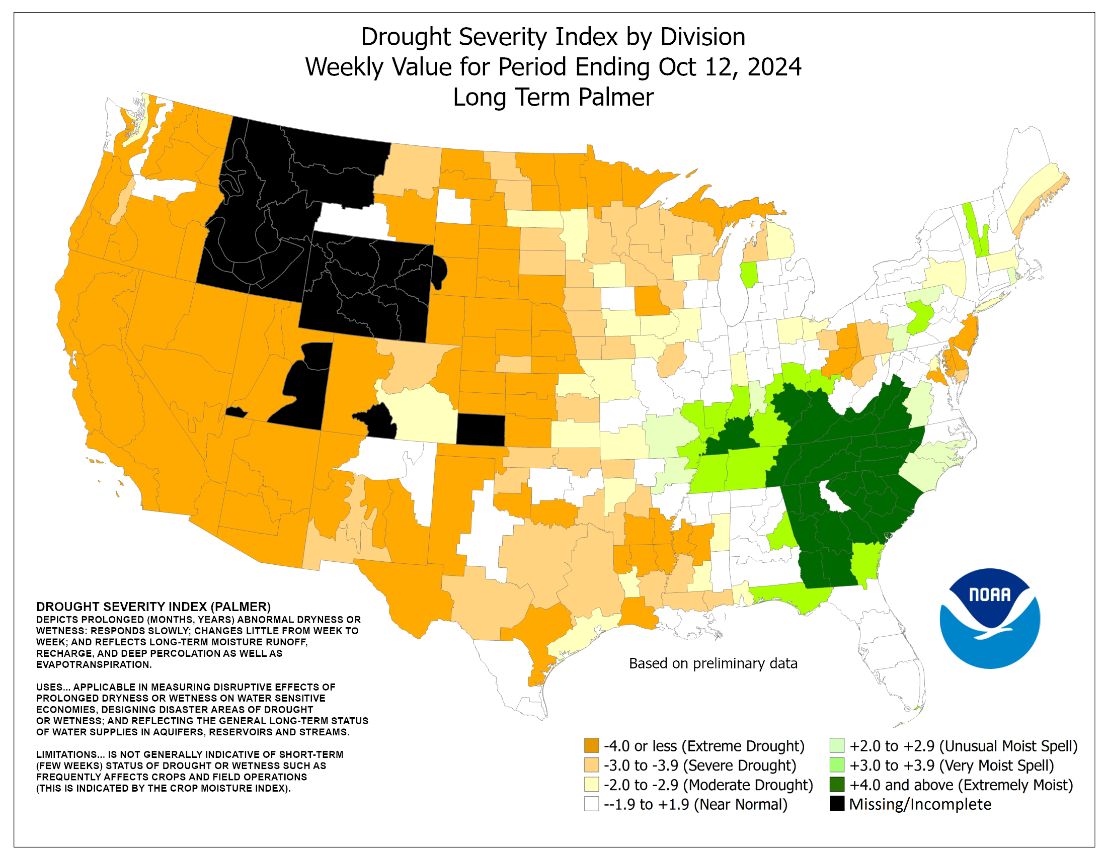
Vermont isn't yet officially in any kind of drought, but some parts of the state are regarded as "abnormally dry" according to thePalmer Drought Severity Index.
A few more rain showers might pop up on Wednesday, but they won't amount to much. After that, we get another stretch of dry weather with low humidity into next weekend. Temperatures will warm back up to the low 80s by next weekend.
An intense storm over the Great Lakes in late
October, 2010.
In Burlington, Vermont, the closest major weather station to my home, aeven of the past ten days in have had wind gusts of over 30 mph.
Early Sunday, gusts reached 44 mph in Burlington, and to around 50 mph or a little more on and right near Lake Champlain.
A lot more wind is due later this week as a vigorous storm arrives. The windy season is here for sure!
As we head through fall and into winter, the winds across much of the Northern Hemisphere really crank up. We sure feel that here where I live in Vermont. I bet you notice it, too, readers in the Northeast, Great Lakes, Great Plains and Canada.
True, we sometimes get our strongest, most damaging winds in summer thunderstorms and severe weather, but that never lasts long in any one place.
During the cold season, the wind might not be as strong as during a severe thunderstorm, but boy it lasts a long time.
Storm systems tend to be weak in the summer, even if they occasionally produce rambunctious thunderstorms and flooding downpours. Since the large scale summer systems are pretty puny, they don't produce much wind in large areas.
During the cold season, the jet stream in the northern hemisphere cranks up to something much stronger than it was in July. The temperature contrast between the Arctic and the tropics increases, and the result is stronger low pressure systems, aka storms.
These stronger storms crank out a lot of wind. Commonly, this time of year, we get "The Gales Of November," made famous in the Gordon Lightfoot classic song "The Wreck Of the Edmund Fitzgerald."
This time of year favors a weather pattern in which storms move north from the southern Plains or Gulf of Mexico, and then intensify to monsters over or near the Great Lakes.
These Great Lakes storms tend to intensify in the late fall because the water temperatures there are still comparatively warm, which adds energy to the atmosphere to give the storms more oomph.
Right now, a storm system is forming in that classic November pattern (which often happens in late October and into early December, too.)
Jet stream energy from the north will combine with remnants from Hurricane Patricia along with boatloads of Gulf of Mexico moisture. That will create a hefty Great Lakes storm, not on par with the Edmund Fitzgerald storm, but still pretty hefty.
Later this week, the Gales of November will blow across the Great Lakes, and into the Northeast, including here in Vermont.
Upper elevations in Vermont could see gusts to 60 mph Wednesday night, and the slightly more populated northern Champlain Valley and northwestern New York especially could have gusts over 50 mph Thursday.
These gales of November are a sure sign winter is coming, as if you didn't know that already.
It you haven't gotten a good enough taste of late autumn Vermont winds, here's a brief, slightly shaky video of my yard in St. Albans, Vermont late in the afternoon of November 1, 2013. Winds were gusting to 50 mph at the time:
It's not clear whether we'll break that record since temperatures are expected to warm up a bit over the next few days in parts of the Great Lakes region.
Blame that persistent jet stream pattern that has kept Arctic air flowing over the Great Lakes all winter.
In fact, the Great Lakes more often than not were in the core of the super cold blasts that kept coming down from the North Pole this winter.
Though not set in stone, the iced over lakes, and the fact the ice will slow the warming of the water in the spring, might mean the cold Great Lakes might contribute to some chill on land in parts of the Midwest and Northeast this spring.