Showing posts with label cold front. Show all posts

Thursday, June 11, 2020

A Little Rain Came Today, Still Could Use A Soaker

Before this morning's rain, we had a breezy, summery evening
Wednesday in St. Albans, Vermont.
It was nice to wake up in St. Albans, Vermont today to the sound of some morning showers moving through. It wasn't anything too heavy, but enough that for once I probably don't have to irrigate the gardens today.

There is a shot at a little more rain as a cold front comes through around early to mid afternoon, but it will probably be hit and miss.

It continues to be drier than it should be for June.  As of midnight, Burlington has had only a quarter inch of rain so far this month, which is an inch below normal.

It hadn't really rained in Burlington yet  today as of 7 a.m., but some showers looked like they would go through that neck of the woods.

I mentioned a threat of severe thunderstorms today in Vermont, and I suppose that might happen here and there, but there won't be anything widespread.  Depending upon how much sun breaks out after the early showers, there might be enough instability to trigger some pretty good, but spotty storms.

This morning's showers might have stabilized the air a bit, which would - maybe - lower the already relatively low chance of severe storms.

If the rambunctious storms do develop, it would come mostly between noon and 5 p.m, earliest in New York and the Champlain Valley.  The best chance of severe storms would probably be in eastern Vermont during the mid to perhaps late afternoon.

NOAA's Storm Prediction Center as of early this morning had all of Vermont in a marginal risk zone for severe storms.  That's the lowest of five alert levels. It means there's a possibility of isolated severe storms, but they'd be limited in duration and coverage.

After today, there doesn't appear to be much chance of more rain for several days.  Another cold front Friday afternoon will probably set off a smattering of showers, but don't look for anything major.

A storm in the upper atmosphere is likely to set up somewhere in the eastern United States over the weekend. At this point,  it looks like it will be too far south to give Vermont much precipitation.  There's always the chance it could pull a surprise and set up further north, but for now, the heavy rain associated with that system looks like it will hit places like Virginia and North Carolina.

So drink up today's water from the sky, dear garden plants.  Looks like I'll be attacking you with the hose in the coming days.

Friday, November 15, 2019

Winter To Slap Vermont Hard Again. Watch It On Roads This Afternoon/Eve

Too early in the season for dealing with this.  Snow slides off my
roof in St Albans, Vermont during today's minor thaw. The sliding
snow tries to block the front door. Another harsh cold wave
is starting this evening and continues through Saturday night. 
This isn't saying much, but today is the warmest day in Vermont since Sunday.  True, it's still chillier than normal and Sunday was cooler than normal, too. But I suppose we have to take what we can get.

This "heat wave" won't last. We have at most a few hours of it, then it's back to hard core winter. That re-introduction to the cold later today will be accompanied by the risk of danger on the roads later this afternoon and evening.

Another Arctic cold front is on our doorstep.  Temperatures ahead of this front are mostly above freezing. Snow and possibly rain showers will develop as the front presses in from the northwest.  This, and the minor snow melt we're getting earlier in the day, will make the roads wet.

Then, as the Arctic cold front comes through, many of us will have some briefly heavy snow squalls, and all of us will see rapidly falling temperatures when the front passes.

This will result in a flash freeze, where wet roads instantly ice over. The snow squalls will create periods of zero visibility in spots, and the snowfall will turn the ice on the roads very slippery.

The snow showers and snow squalls won't last long in any one place. Almost everyone will get an 1.5 inches of new snor or less. But that's enought to make things wild and dangerous on the roads during and immediately after the squalls.  The worst of it will be in the northern half of Vermont.

The timing of this is lousy, heading from northern New York at mid afternoon, then going northwest to southeast across Vermont in the late afternoon and evening. Just in time for the evening commute.

Expect the National Weather Service to issue snow squall warnings in areas of northern Vermont and New York later today. These warnings are much like severe thunderstorm warnings in the summer.  Each one will cover only one or a few counties and reference dangerous weather lasting for only an hour or two in a given area.

Some places will get it worse than others.  Some places won't even get snow squalls. But the risk of a mess is such that, if you can, get home before the snow squalls arrive.  If you're still at work or whatever when the snow showers and squalls hit, just hang out where you are until an hour or two after they pass by.

The roads will still be icy in spots, but at least the visibility will have improved and the road crews will have begun to clean things up.

Temperatures will crash right after the front and go right back down to record low levels tonight through Saturday night. This cold snap will be even stronger than the one we just had.  Lows tonight will be in the single numbers and only go into the teens to around 20 for a "high" Saturday

Lows Saturday night will also be in record territory, with temperatures of between minus 5 and plus 5 for most of us. That's just incredibly cold for mid-November and something that's not in the record books.

Winter isn't going anywhere, either. Tempertures will warm up next week, but still stay generally cooler than normal for this time of year. (Forecast highs are in the 30s to around 40, with lows in the 20s).

The exact track of upcoming storms and fronts starting Monday and through next week are uncertain, but we have good chances most days next week of a variety of winter precipitation. Ugh.

Friday, August 23, 2019

Yesterday's Cold Front Was Beginning Of End Of Summer

Won't be long until things start looking like this.
I was miserable working outside late Thursday morning in Burlington, Vermont. The air was still with no wind, the humidity was horrendous and sweat was pouring off of me with the intensity of a downpour, I swear.

Suddenly, a breeze pushed in from the west and the humidity vanished almost instantaneously. A cold front had arrived. The dew point, a measure of how humid it is, dropped from an oppressive 66 degrees to a comfortable 54 degrees in just an hour.

I continued to work - much happier now - well into the afternoon. It's amazing how a shot of cooler air can help one's ambitious.

Cold fronts and bouts of lower humidity always come through Vermont during the summer. This one, though, felt like the first hint that summer will end.

Oh sure, there will be more warm to hot days as we finish out August and head into September.  And the humidity will eventually creep back up again. But the average temperature is now falling with shorter days. We'll be getting into what Vermonters call "fair weather."  Kinda even today and tomorrow.

Fair weather is not necessarily the sunny skies the term implies, but in this case the skies will be mostly blue.

Fair weather is that kind of in-between temperature you get in late August and early September when it's not really warm, but not really cool. You wear a t-shirt in the afternoon and snuggle into a hoodie in the evening. This kind of weather comes when local fairs do their annual runs, hence the term.

In this case, the next few days will feature highs in the low to mid 70s under mostly to partly sunny skies. Nights will get into the 40s in many areas. Bring those sweaters and hoodies with you!

You can see other signs of the changing seasons. Some of the weaker sugar maples show hints of color, a preview to the big annual foliage show nature puts on every year.

This has been the second summer in a row in which cold fronts have been lacking in Vermont. It's been consistently toasty.

There are summers in which we feel cheated out of them. You know, the ones where it never seems to get hot, and always rains.

This summer and last featured plenty of true summer weather. I usually feel wistful when "fair weather" hits, confirming that summer is ending. But we had our share this year. I'm ready for autumn.

Sunday, July 21, 2019

My Favorite Cold Front Of The Year Comes Through Today

Yesterday, July 20, afternoon temperatures were in the 90s with
heat indexes around 100 degrees. Exactly six moths earlier,
on the afternoon of January 20, this was the scene in
front of my St. Albans, Vermont house. 
Dozens of cold fronts pass through Vermont every year. Some of them bring improvement to the weather, others make things worse.

Today's cold front, a true gift from Canada, will surely become my favorite cold front of the year.

I wilt in heat and humidity, and this has most certainly been wilt weather over the past couple of days.

This hasn't been a long heat wave, but it sure has been oppressive. The old saying, "It's not the heat, it's the humidity," is certainly true.

Dew point temperatures are a good measure of how humid it is. If the dew point is over 60, you begin to notice a bit of stickiness to the air. If the dew point is 70 degrees, it is truely oppressive.

Yesterday, Vermont's dewpoints were mostly in the 70 to 75 degree range. At one point last evening, Highgate reported a dewpoint of 80. If accurate, which is admittedly iffy, it would be the highest dew point I've ever seen in Vermont.

For perspective, dew points of 80 degrees happen a few times every summer in places like New Orleans and Miami, but even there, it's not an everyday occurance.

High dew points mean temperatures warm at night. Drier air leads to cooler nights. The high dew points were the main reason it stayed so stuffy last night.

The cold front I referred to is actually coming through in two pieces. The first one was entering northern Vermont as of 11 a.m. or so, when I was writing this. I noticed from my perch in St. Albans, Vermont that the wind has picked up a bit and the sky darkened a bit as a narrow, broken line of showers approaches.

That line will probably intensify as it moves southeastward through Vermont today. There won't be widespread trouble with this, but a few isolated storms will become strong.

In northern Vermont, you'll notice that the humidity will have waned a bit behind this first boundary this afternoon. This first front comes through later in southern Vermont, so it will stay hot and humid, with heat advisories remaining in effect there.

The second, main cold front will come through Vermont this evening and overnight. There won't be much weather along this one either. Just scattered showers and thunderstorms, one or two of which might be strong.

You'll really notice the humidity drop down overnight.

The lack of rain with this cold front is a little concerning. There were scattered storms last evening, but not everybody was hit. The same is true today.

The cold front is still expected to get hung up in southern New England tomorrow. A disturbance riding along this front will bring a soaking rain into southern and central New England, including southern Vermont

Far northwestern Vermont seems to be getting a little dry, despite some downpours last Wednesday. It's uncertain, but it looks like this soaker might miss northern Vermont. Which is too bad.

At least it will be comfortably cool for a few days. But it looks like warmth and humidity will make a return starting next weekend. It's a little soon to determine how icky it will get. But at least we get a break.

Saturday, July 20, 2019

Heat Wave Peaks Today; Iffy Forecast For Storms And Rain

Yesterday's heat and humidity made the lower atmosphere unstable
over St. Albans, Vermont last evening, resulting in these pretty clouds.
Storms did not develop because there was another warm layer above,
which prevented the strong updrafts you need for storms
So we got these nice little clouds instead.
The heat wave that has engulfed Vermont and most of the rest of the nation's eastern half should peak today, then slowly begin to wane in most places

It's a doozy, even if not that many records are being set. There will be a few record highs, but what's striking is the warm overnight lows. Several cities will set a record today for the highest minimum temperature for the date. 

Burlington, Vermont did manage to get down to 72 degrees this morning, which is hot, but not unprecedented. It'll get into the 90s today in Vermont, with heat indexes approaching 100 degrees.

Needless to say, we're still under a heat advisory.

It's worse elsewhere, of course. I don't think it got below 80 degree last night in Boston, for instance. 
There's a chance it could reach 100 degrees in Boston today or Sunday. If it does make it to 100 in Boston, it'll be something like only the 25th time in 140 plus years of record keeping.

Cities like New York and Washington have a good shot at cracking 100 degrees today.  People are wisely cancelling strenuous outdoor events, which can give people heat stroke. In New York City, for instance, a triathlon is off the table for today, as is something called OZY Fest, which would have drawn big, eclectic names like John Legend, Trevor Noah, Rachael Ray and Beto O'Rourke.

Some events in Vermont are canceled or postponed due to the heat, too. Ironically, this heat wave is a bit like a blizzard in that it's cancelling events.

It is good though that strenuous things are being put off. This heat is dangerous. Among the people succumbing to heat stroke yesterday was former NFL player Mitch Petrus, who died while working outside his Arkansas shop on Friday.

Here in Vermont, as hot as it is, I doubt we will have a record high temperature. On this date in 1977 there was a super impressive heat wave that brought temperatures up to 99 degrees in Burlington. It won't get that hot today.

Still, be careful! The humidity is way up there, so heat indexes will be up around 100 degrees, as I've already noted.

It's still unclear whether thunderstorms will help break the heat, even when a cold front comes into play on Sunday. Often, heat and humidity ends with an outbreak of frequent thunderstorms, but not always.

This appears to be the case. Depending on whether anything can get triggered, some thunderstorms could erupt this afternoon and evening. I don't think they'll be particularly widespread, but given the rich environment, any that do get going could get pretty strong pretty fast.

We still have that layer of warm air which would block updrafts, but a weak boundary coming through today might provide just enough lift in the atmosphere to trigger a storm or two.

It is a bit unpredictable when you're on the northern edge of a heat wave, like we are now.  Big complexes of storms or derechos can form. One derecho or severe storm complex has gotten going early this morning in South Dakota and is beginning to race eastward. Even if it aims towards us late tonight, I imagine it will weaken greatly before it gets here. Still, it's worth watching.

The Storm Prediction Center has us in a marginal risk zone for severe storms today and tonight.

Even as the cold front comes through Sunday, the storms will be hit and miss. Not everyone will get 'em. It will remain hot and humid Sunday, especially in southern Vermont, which will be the last to see the cold front.  You'll start to notice the fresher air in the evening across the north, and statewide overnight Sunday night.

The front will get hung up in southern New England Monday, and a little storm will ripple along it. That would bring rains to parts of the area Monday and Tuesday. Nobody is quite sure yet where the front will stall, which means nobody knows where the heaviest rain might fall. There is a chance that parts of Vermont could get some pretty heavy downpours Monday and/or the first half of Tuesday.

It's still looking nice and cool next week, though as we get toward Friday it might start to warm up again. But not to the extent we're dealing with now.

Wednesday, September 19, 2018

Autumn Arrived Last Evening In Vermont. We Mean It This Time

This cool, cloudy September morning, after an odd stretch of very
warm, humid weather broke, signs of fall color around my
St. Albans, Vermont house. 
Yesterday was another frustratingly warm, too humid day in Vermont. An expected cold front was tardy, so relief from the neverending summer was not forthcoming.

Until late afternoon and evening, that is, when that cold front gloriously dropped down from Canada.

I was sweating it out in the garden, trying to get some work done. I was cursing the heat, how it was making me drag.

Then that north breeze finally came up. The tardy cold front was finally here.

Within a half hour I went from melting into the heat to drinking in the suddenly cooler, drier air. Boy did I feel re-energized!

We'd just endured six consecutive days in the 80s and four consecutive days at or above 85 degrees. At Burlington, Vermont, Tuesday was the 82nd day this year that got to 80 degrees or more

The cool air that came in last evening was a relief for sure.

This cold front was the end of summer in Vermont. Period. Oh, sure, we'll have a couple or few more days that will be warm and summery. Possibly even humid. This coming Friday looks like it might be one of those days, for instance.

But normal temperatures are now so low, and sinking fast, that it would take near record or record heat to push us back into never-ending summer. While such a spell is always possible, it's unlikely.

Plus, any hot spell will be quickly dispatched by our increasingly vibrant cold fronts from Canada.

Today, for instance, is cloudy and cool. Though there might be some sun in the afternoon, temperatures will stay in the 60s. It'll be comfortably cool tomorrow as well.

As mentioned, Friday could end up feeling summery again, but that relative warmth and humidity will quickly be swept aside by a Friday night cold front. The weekend will be cool. In fact, Saturday night be turn frosty in some northern and central cool spots.

That would be good timing. Astronomical fall, the autumn equinox arrives at 9:54 p.m. Saturday.

By the way, there are some hints that the switch to a fall pattern might be slighly wetter than the too-dry weather we've had all summer in  northern Vermont.

We're in a drought and need the rain. I don't see any blockbuster signs of torrential, soaking rains, but those increasingly frequent cold fronts at least give us periodic chances of wetting.

Friday night's cold front doesn't look super impressive in terms of rainfall, but we have a shot at some. Additionally, a few of those cold fronts over the next couple weeks look like they have a chance - just a chance - of picking up some extra moisture from the Gulf of Mexico, which would make the rain a little heavier.

For what it's worth, NOAA"s Climate Prediction Center indicates slighly better than even chances of somewhat cooler, somewhat wetter than average weather here in Vermont as September closes and October opens.

We'll see how that goes.

Wednesday, September 5, 2018

One More Wicked Hot Day In; Gordon Unleashes Floods, Florence Confounds

Heat indexes in the Champlain Valley later this afternoon could
get over 100 degrees. In September1
I'm still in Yankton, South Dakota missing, or more accurately, not missing the latest big hot spell in Vermont.

Once again, it's one of those never ending summers, although the break in the heat that's coming is HUGE. You're going to be shocked.

First, the North Country has to get through today. You know the drill. There's heat advisories in the valleys, as heat indexes will get into the 95 to 100 degree range.

The record high in Burlington today is 90 degrees set in 1973. That should be broken today.

Last week I said I doubted it would get into the 90s again, but, well here we are. I'm thinking this will be the last 90 degree day of 2018, but there's no guarantees of that.

The glorious cold front from Canada will come through Thursday morning. After today and tonight, we're into autumn. Or at least a less horrible version of summer.

The humidity will keep you awake tonight, and some rumbles of thunder might also do the same. When you wake up in the morning, it will be oppressively humid. When you get home from work in the evening, well, welcome to autumn.

And autumnal it will be this weekend. High temperatures will only get into the 60s, with some upper 50s in the cool spots. Everybody except those right along the shores of Lake Champlain will be down in the 40s Saturday night.

The cold hollows will get into the 30s Saturday night, and I have to wonder if the first frost advisory of the fall season will be issued for those regions.  Don't worry, most of us won't lose our remaining gardens to the frost.

Warmer, more summerlike weather will be back next week, but don't worry. It won't be in the 90s.

TROPICAL STORM GORDON

The future potential track of Gordon will hit Arkansas and
surrounding areas with heavy rain. The remains of Gordon
might give us Vermonters a little rain early next week.
Tropical Storm Gordon made landfall as expected on the northern Gulf Coast last night. It didn't quite make it to hurricane status, but it's still a big troublemaker.

One person has died after a tree fell on a mobile home and killed a child. Which is tragic enough. Gordon hasn't done its worse yet.

True, the winds have died down to safe levels. But the storm will continue to dump heavy rain from Alabama to Arkansas over the next few days, and serious flooding is a virtual certainty.

The Midwest is still soggy from days and days of rain, and the flooding from Gordon will likely extend into Missouri and Illinois

The remnants of Gordon will probably be entrained into a weather front coming into New England Monday. That means we here in dry Vermont still have a shot of getting some needed rain. At this point, the Gordon remnants do NOT look like any kind of blockbuster for Vermont, but any rain would help.

HURRICANE FLORENCE

As you can see by this map of different computer model
predictions for Hurricane Florence, nobody knows
where it's going, so don't even think about it just yet. 
Hurricane Florence is still way out over the central Atlantic, but it's confounding forecasters with its strength and unpredictable path.

Florence, defying all forecasts, has become the first major hurricane of the season in the Atlantic, witih top sustained winds as of late this morning of 125 mph.

Projections had indicated it would stay a tropical storm or at most barely a hurricane, then weaken some due to strong upper level winds.

The National Hurricane Center is guessing that Florence is in a pocket of light upper level winds in an area where those winds are generally stronger. For now, the NHC has pretty much given up on forecasting the storm's intensity over the next few days. It's hard to say if those upper level winds will weaken the storm again, or cause it to grow.

The eventual path of Florence is an even bigger wildcard.  When hurricanes get as far north as Florence is now, they almost always recurve to the north and miss the United States.

But not always.

This could be one of those "but not always" scenarios. Strong high pressure to the north could steer the storm toward the United States. Some computer models emphasized that westward turn this morning.

Don't count on it, though. As noted, the computer forecasting models are really struggling with how to figure out Florence. Some projections keep it going west. Some turn it north and away from the East Coast. Some of the computer models are so flummuxed that they're coming up with bizarre scenarios.

One model actually had Florence eventually becoming an enormous storm over Maine or Quebec, tapping into polar air and causing a very gusty, nasty snowstorm over Vermont and other areas of northern New England on September 19.

I don't know what Florence will do, but I guarantee she WON'T do that. Don't bother getting your snow shovels out yet.

Bottom line: For now, people should just keep Florence in the back of their minds, and if it comes close to the East Coast next week, then start paying attention.

Saturday, July 7, 2018

Hodgepodge Of News: Quebec Heat Deaths, California Heat, Hurricanes, Haboobs And More

California Highway Patrol took this photo of a big wildfire in the northern part
of the state. Wildfires are breaking out throughout the west as record
breaking heat envelops the region.
I hope you love this change in the air over northern New England. I know I do.

The turn toward cool, dry air Friday was pretty dramatic over Vermont. We started the day with dew points in the terrible 70s, but by evening the dewpoints were down in the autumnal 40s.

 The push of cool air was so strong that northwest winds at times gusted to near 40 mph. The wind actually managed to bring down a few small branches. 

By this morning, all of us except those right near Lake Champlain had temperatures down in the 40s, with a reading of 37 degrees reported at Saranac Lake, New York.

Enjoy the cool temperatures. They won't last long. This upcoming week looks like a warm one, but luckily it won't be nearly as bad as last week.

A squirt of hot air from the southwest on Monday will probably pop us Vermonters back up into temperatures of around 90 degrees again. However, it won't be as humid as last week.

A weak cold front will drop us back into the low 80s the rest of the week.

TROPICAL TROUBLE

Two tropical systems -- the ever-surprising hurricane Beryl and a tropical depression off the Carolina coast, could have some influence on our weather over the next week or two

The depression off the Carolinas will probably strengthen into Tropical Storm Chris. It won't directly influence us, but will likely make the weather kind of so-so for us during the middle of the week. The air near the surface of the Earth will stay warm, but wannabe Chris is helping develop an upper level trough over the East.

That means cooler air aloft, creating instability and the risk of showers and thunderstorms. Which would be a good thing, because we need the rain. However, there won't be much moisture to work with, so any storms and showers will be widely scattered, brief and not worth much. And they might not even happen at all. We'll wait and see.

Wannabe Chris is expected to eventually head toward the northeast, away from the U.S. coastline

Meanwhile, Hurricane Beryl, that tiny storm heading toward the Lesser Antilles, continues to surprise with its strength and resilience. It was supposedly still cranking at 75 mph near its small center this morning, and could clip some of the Lesser Antilles with hurricane conditions over the next couple of days. 

But I doubt it. Beryl looked like it was already weakening, judging from the satellite pictures.

It's still forecast to weaken as strong upper level winds rip Beryl apart in a few days, but it could have enough oomph to give places like Puerto Rico and the Dominican Republic some wind and rain - something they don't need after last year's devastating hurricanes. 

It's possible - but highly uncertain - that the remnants of Beryl could throw some warmth and higher humidity our way by the end of next week. Nobody's sure about that, so stay tuned.

INCREDIBLE HEAT KEEPS POPPING UP

Yesterday, it was southern California's turn to get into some unprecedented heat, a phenomenon that's really been a thing so far this summer in the northern hemisphere.

Burbank reached 114 degrees and Van Nuys got up to 117 degrees, which establishes new all time record highs for any date. What makes this even more unusual is southern California is usually relatively cool in July. Their hottest month is usually September.

Downtown Los Angeles got up to 108 degrees Friday, smashing the old record high for the date, which was 94 degrees. San Diego also broke a record high for the date, reaching 96 degrees, breaking the old record of 83 degrees.

The heat, predictably, helped fuel September-like wildfires break out in southern California Three thousand people have been evacuated, and up to 20 homes have been destroyed by fire in Santa Barbara County.

WEATHER DISASTERS CONTINUE

That big cold front that gave us here in Vermont relief from the heat obviously also swept through southern Quebec, ending their deadly heat wave. At last report, 54 people had died from the heat in Quebec.

I'm sure everybody in the Montreal area was thrilled by the dry, cool air that came in during the day yesterday. This whole episode is more proof, as if we needed it, that heat waves can be among the deadliest weather disasters.

Speaking of weather disasters, western Japan has been hit by serious, deadly flooding. As many as 46 people have died, and more are missing. Two million people have been evacuated due to the flooding and mudslides, including areas around the big cities if Kyoto and Hiroshima. Up to three feet of rain has fallen in some areas.

Japan is used to heavy rain events in the summer, but not ones of this magnitude.

ARIZONA HABOOB

This is the time of year that Arizona and other parts of the desert Southwest get their famous haboobs. These are big dust storms created when a rather dry thunderstorm sends out a big gust front that stirs up a wall of dust.

These are obviously dangerous, as they can blind motorists on highway. This one, as usual, disrupted traffic. Here's a brief video of the dust storm approaching:


Friday, July 6, 2018

Yes, Humidity Was Terrible Last Night And This Morning, But......

Small, brief pop up thunderstorms formed last evening across
New York and Vermont, which were the first signs the heat wave
was about to end. This storm was over northern New York, as
viewed from St. Albans, Vermont at around 6 p.m. Thursday. 
We endured one more awfully lousy, stuffy sleeping weather overnight as our heat wave gets ready to draw to a close.

If anything, the heat and humidity made this the worst night yet.

It was still 83 degrees at midnight in Burlington, with a heat index of 88 degrees, so it was terrible.

Some showers and thunderstorms did break out early this morning, but in many places, it didn't rain as hard as I would have hoped.

We really need the rain, and this upcoming cold front is a disappointment in that regard. Only a few more showers will come down before the front goes by.

The front will NOT be a disappointment in ending this horrible heat and humidity, but we'll have to be a little patient early this morning, especially the more south and east you go. By 6 a.m this morning the front had entered northwestern New York - Massena's dew point dropped from 71 to 64 degrees within an hour.  It will soon cross Vermont and will move out of southeastern parts of the state by early afternoon.

As the day goes on, you'll really notice a sharp drop in humidity levels. Temperatures in the 70s early this morning should pretty much stay there, except pop back up into the low and 80s across southeastern Vermont.

Tonight will be a spectacular night for sleeping in the North Country. I promise. Pretty much everybody will get down into the 45 to 55 degree range, which is actually cooler than normal for this time of year.

I wouldn't be surprised if the very coldest hollows like Saranac Lake, New York and Island Pond, Vermont get down to something like 39 degrees. Yes!

As the heat closes, Burlington and other areas of Vermont continued to set new records. For the third time in a week, the summit of Mount Mansfield tied its all time record high of 84 degrees. The six days ending yesterday were the hottest six day period on record for Burlington, with a mean temperature of 83.5.

In Quebec, the death toll from the heat wave has risen to 33 people, with 18 of those in Montreal. I described this heat wave yesterday as one of Quebec's worst weather disasters, and as you can see, it has gotten even worse. I bet there will be more death reports in Quebec, as last night stayed hot up there, too.

I'm pleasantly surprised there have so far been no reports of heat deaths in Vermont, though a man participating in a trail race died of heat stroke last Sunday in the Adirondacks of New York.

LOOKING AHEAD

As nice as the cool blast will be, it won't last that long, and, as it turns out, it will be somewhat hotter starting Sunday and continuing through next week than we might have thought earlier.

Before you panic, we are NOT returning to days on end of highs in the mid 90s with stifling humidity like we just experienced.

Sunday, after a cool start, will turn into another great beach day. There will be lots of sun and temperatures will spike into the mid 80s in many location. Pretty toasty, yes, but the humidity will still be low.

Monday looks warmer still, with highs in the upper 80s, with a few spots maybe making it to 90 degrees.

It has seemed like the heat ridge that gave us this terrible hot weather will migrate west and give the western half of the nation a big heat wave. That's still true, but the heat ridge will sort of elongate next week to cover most of the nation

We'll be on the edge of it, and far enough north and east so that little cold fronts and disturbances zipping through will keep the worst of the  heat at bay for us. It will be a warm week, with temperatures in the 80s probably every day. But humidity will generally be moderate, and I still don't see signs yet of another big heat wave looming. We'll just settle into typical summer weather next week.

THE TROPICS TURN ACTIVE

While we were focusing on our heat wave the tropics got active both in the Atlantic and Pacific Oceans.

Surprising just about everyone, we now have Hurricane Beryl way out over the central Atlantic, east of the Lesser Antilles. We usually don't have hurricanes forming in this location until later in the season, but there you go.

Beryl was expected to just be a piddling weak tropical storm, but it surprised everyone by becoming a hurricane this morning with top winds of 75 mph. It'll probably strengthen a bit more today.

Beryl is a tiny little thing, as hurricanes go. Hurricane force winds extend out only 10 miles from its center, and tropical storm force winds of 39 mph only go out 35 miles from the center. To give you an idea how small this thing is, imagine if it was centered over Montpelier, Vermont. Beryl's outer edges would barely make it into eastern New York and western New Hampshire.

The fact that Beryl is so itty bitty means it can be torn apart easily by strong upper level winds if they develop. They are indeed expected to develop, and Beryl will probably fall apart as quickly as it formed, and do so before it reaches the Lesser Antilles.

Meanwhile, there is another disturbance halfway between the southeastern United States coast and Bermuda. Forecasters give it only a 50-50 chance at best of turning into a tropical storm, but it's still worth watching as it meanders off the coast over the next few days.

It turns out Maria is a bad name for hurricanes. We had Hurricane Maria last year, which as we know devastated Puerto Rico and other islands to the point where they still haven't nearly recovered. (The power blackouts on Puerto Rico are only now just ending.)

Now we have Typhoon Maria. (Typhoons are what we call hurricanes in the western Pacific Ocean, near Asia.)

Maria is now regarded as a "Super Typhoon," the equivalent of a very strong Category 5 hurricane in the Atlantic. Typhoon Maria has sustained winds of 155 mph. It could affect Japan and China next week, but the typhoon, if it gets there, will likely have weakened somewhat, which is good news.


Friday, November 10, 2017

That Impressive Cold Front Last Night Will Bring Near Record Cold To Some Northeast Cities

Boy, that was as impressive of a November cold front as you could get last night.

City forecast that are circled are where record
lows are threatened Saturday morning. Click on
the map to make it bigger and easier to see
When it rolled past my house shortly before 12:30 a.m. it was accompanied by thunderstorms, which brought cloud to ground lightning, loud thunder and quite a bit of pea-sized hail.

The National Weather Service office in South Burlington also reported thunderstorms.

As expected, the temperature plummeted behind the front, as strong northwest winds are blasting the cold air into the Northeast.

The strong winds will continue today and wind advisories are up for sizeable portions of New York and New England. Winds could gust to 45 mph, which would cause some scattered power outages once again

Temperatures before dawn ranged from the teens in northern New York to the 30s in central New England. Those temperatures will either stay steady or continue to fall the rest of the day.

Although not unprecedented, this is a strong cold snap for mid-November, and quite a few record lows for the date will be broken across the Northeast. The record low for Saturday in Burlington is 16 degrees, and current forecasts have the temperature dropping to 14 degrees.

I still wouldn't be surprised if a few of the cold pockets in the mountains get to zero.

The last time I saw a cold snap that threatened so many record lows was Valentine's Day, 2016.

Already, some records in the Midwest have fallen. It's even worse than here in some northern zones out that way.

International Falls, Minnesota, normally considered an icebox, is even more so. Both yesterday and this morning, it got down to 13 below in International Falls, breaking yesterday's daily record of 0 and today's daily record of -6. Duluth, Minnesota also saw record cold yesterday and today.

The record low of 18 degrees in Chicago was tied. At last check, Green Bay, Wisconsin had set a new low temperature record for today's date with 11 degrees.

However, like that Valentine's cold snap, the current one will be brief. We just have to endure a couple days of cold. By Sunday afternoon, temperatures will not exactly be warm, but not far from average for November.

Those highs Sunday in the upper 30s to mid 40s in Vermont will seem tropical after today and Saturday.

Tuesday, November 7, 2017

Winter To Finally (Briefly) Hit At The End Of The Week

We might get a dusting of snow, like this one pictured last
November in St. Albans, with a strong cold front Thursday
night. Winter cold to follow Friday, Saturday.
Yesterday's post remarked about how warm the autumn has been and how things are still growing in the garden and all that jazz.  

True, but we New Englanders now need to rush our winter preparation to completion, as winter is going to hit very abruptly, but probably rather briefly late in the week.

It'll be seasonably cold through Thursday, with highs in the upper 30s and 40s across Vermont, but then, watch out! A strong cold front will arrive Thursday night.

Some snow showers or even snow squalls will probably accompany the front, especially in the north and mountains.

Accumulations won't amount to all that much, but the dustings of snow along with the rapidly falling temperatures will almost certainly slicken up many roads later Thursday night and for the Friday commute.

Yeah, it's that time of year.

For many of us in northern Vermont, the temperature will fall below freezing Thursday night and not rise above freezing again until Sunday. Friday will seem brutal, even though we can get this type of weather in mid-November.

But how brutal? Try high temperatures in the 20s with winds gusting to 30 mph. That translates to a wind chill in the single digits. Some of us have yet to see an overnight low in the 20s, so this will seem like quite a shock. By the way, the last time we had a day with a high temperature that stayed below freezing, at least in Burlington, Vermont, was way back on March 16.

On the bright side, this will finally get the Vermont and other north country ski areas to get their snow guns out, and start covering slopes with what will hopefully be ski-able snow soon.

On the even brighter side, if you don't like deep cold, winter will ease its grip for a little while after Saturday. Temperatures will begin to ease up later Saturday and by Sunday and Monday, we'll be back in the 40s again. Not warm, exactly, but not midwinter conditions either.

Tuesday, July 18, 2017

Chile Is Chilly: Snow In Santiago A Contrast To Our Humidity

A street in Santiago, Chile after a rare snowstorm
hit the city last Saturday.
If you're no fan of the typical summer warmth and humidity we're getting this week in Vermont, I've got a small piece of good news.

Plus some news out of Chile that will hit you like your favorite summer creemee.

First locally: It appears we could get the strongest cold front in weeks toward the end of the week. It could really be on the cool side this weekend.

It's still unclear how strong this push of cool air might be, but it will probably be refreshing. Even, if expected, it won't last long. Although I still don't see any big heat waves on the horizon, either.

If this new isn't good enough for you, take a mental trip to Santiago, Chile.

It's winter down there, and over the weekend, the biggest snowstorm in at least a decade hit that city.

Granted, it wasn't a huge snowstorm - just on the order of one to three inches - but there' not that used to snow in Santiago. (Normal high temperatures in a Santiago mid-winter, i.e. now, are in the upper 50s with lows in the upper 30s. Kind of like a Vermont April.)

Although Santiagoans loved the rare chance to have snowball fights, it wasn't all fun and games.

The wet snow broke many branches and power lines, leaving more than 330,000 residents temporarily without electricity. One person died after he was injured while clearing ice, and two people were injured by fallen power lines.

Here's video of Saturday's scenes in Santiago.


Thursday, July 13, 2017

Odd Summer Temperature Contrast Causing Havoc-Strewn Weather Wisconsin To New England

Lightning strikes the tarmac of O'Hare airport in Chicago
as that region shared in the severe weather along a stalled
weather front from Wisconsin to New England. 
Almost always in mid-summer, there's not much of a temperature constrast on either side of a cold or warm front.

Unlike in the winter, there's no grand pushes of cold air from Canada to feed these dramatic contrasts. So in the summer, when a cold front goes through, the temperature might drop just a few degrees. Or not at all.  

Not this time.

An unusual push of very cold air for this time of year pushed southwestward from Greenland, where there was some big time almost record breaking snows.

The front has pushed down through Quebec, where snow fell last night in the northeastern part of the vast province.

The front has settled down into the Great Lakes through southern New England, where it is stalling out and doing battle with the usual intense heat and humidity of summer across most of the rest of the nation.

The result is some very bad weather that's been going on for the past couple of days in numerous spots. This bad weather will continue for a few more days -- though here in Vermont we seem to be escaping almost all of it.

Here in New England, the chill north of the front is being enhanced by east and northeast winds that are bringing even cooler, more damp air in from the North Atlantic.

In northern New England, including northern Vermont, high temperatures won't get out of the 60s today. The same is probably true for Friday.  Normally, afternoon temperatures are in the low 80s this time of year.

Near the coast, the shift is even more dramatic. At mid-afternoon today, the temperature in Boston should only be around 60 degrees with a raw east wind.

Justt 50 miles or so south of Boston, on the other side of the front, Providence, Rhode Island is forecast to be at 88 degrees at the same time. Quite a difference.

Such a sharp temperature contrast is a recipe for strong storms and heavy rain near and just south of the frontal boundary, and that's what's been happening.
Torrential thunderstorms caused flash flooding in
Belmont, Massachusetts Wednesday. 

The front yesterday and today extended to the western Great Lakes. The nearly stationery front, and heavy storms along it, caused terrible flooding Wednesday in Wisconsin and northern Illinois.

Severe thunderstorms struck parts of southern New England on Wednesday, too.

Today, flash flood watches are up for a broad area from Indiana to western New York.

A particularly heavy batch of rain was over the western third of New York as of mid-morning, and flash flood warnings were up for a big area that included Buffalo and Rochester.

The weather boundary won't be going too far any time soon. It will become more diffuse, becoming more like a summertime weather front with not so big temperature contrasts.

Still it will remain a focus for rounds of showers and thunderstorms through next week as weak disturbances ride along the boundary, making it waver back and forth, north and south.

Here in Vermont, that means an almost daily chance of showers through next Tuesday. It's hard to pick out exactly when it will rain and how hard during this period. At this point, I don't see anything extreme coming for the Green Mountain State, but it's something to watch.

Tuesday, June 13, 2017

No Big Storms Here, But Plains States To Take Battering Today For 3rd Day.

Quincy Vagell tweeted this photo of a tornado and
lightning near Grover, Colorado Monday. 
The brief heat blast here in northern New England is slowly coming to an end today, without many fireworks.  

We did have more record highs in Vermont Monday. The temperature of 94 degrees broke a record high in Burlington for the second day in a row.

The day's minimum temperature of 71 set a date record for the warmest minimum temperature for June 12.

Montpelier on Monday had a record high of 88 degrees. So did the summit of Mount Mansfield, at 76 degrees.

Often, when a heat wave ends, as is currently happening, severe thunderstorms break out. But the timing of the front, as noted yesterday is all wrong, so we didn't get severe storms and won't.

There were a few isolated thunderstorms as the cold front sagged south from Canada, but no big deal.

The cold front is moving more slowly than earlier thought, and as of mid-morning the humidity hadn't cleared yet. Plus, an area of showers and thunderstorms along the front will affect portions of Vermont later this morning and early afternoon, especially from about Montpelier south.

Further south, there might be some strong storms in southern New England and the Mid-Atlantic states as the cold front invades the hot weather still sitting over those locations this afternoon.
Aftermath of a big hail storm in Coon Rapids,
Minnesota on Sunday.

While we had nothing scary in terms of storms, the Northern Plains and Front Range area of Colorado and Wyoming and Montana have had lots of bad weather lately.

Sunday, a storm complex and derecho formed in South Dakota, raced across Minnesota, including the Minneapolis area, and on into Wisconsin.

The hail and wind damage was wild with that one, as you can see in the video of the storm below, in Brooklyn Park, Minnesota, northwest of Minneapolis.

On Monday, there were 32 preliminary reports of tornadoes, mostly in Wyoming and Nebraska. Luckily, no deaths have been attributed to the twisters, though there were a few injuries and some houses were destroyed in strong tornadoes.

There's a video at the bottom of this post of a destructive tornado in Harrisburg, Nebraska on Monday.

Today the action moves back to the northern and central Plains, especially the eastern halves of the Dakotas (watch the skies, dear relatives of mine in Yankton, South Dakota!) and eastern Nebraska and much of Minnesota and northwestern Iowa.

Not everyone in this region will get severe weather of course, but there is the risk of tornadoes, huge hail and damaging straight line winds.

Back east over Vermont, it'll actually feel almost chilly Wednesday behind the cold front with highs only in the 60s and low 70s and lows in the 40s to around 50.

It'll turn more humid again over the weekend with the risk of showers and storms, but it won't turn super, super hot like it's been the past couple of days. Still maybe uncomfortable on Sunday, though, depending on the timing of weather fronts

Here's the incredible hail and wind storm in Brooklyn Park, Minnesota on Sunday (The filmmaker replaced the cacophony of hail with a nice song:


Next, a news video of so much hail in Coon Rapids, Minnesota Sunday that people had to get their snow blowers out to clear it:


Finally, a destructive tornado in Harrisburg, Nebraska Monday:

Monday, December 19, 2016

That Was One HELL Of A Cold Wave

Lots of people were thinking this in the Northern Plains
and Midwest over the weekend. H/T to John
Howland for posting this cartoon on Facebook
An epic cold wave over the Plains and Midwest will start to fade today after breaking numerous rlow temperature records.  

A lot of the record lows were broken by large margins.  

Some examples, according to the Weather Channel:

First, Saturday:

Pueblo, Colorado, -19, old record -10.
Garden City, Kansas: -13 degrees, old record -1
Aberdeen, South Dakota: -32 degrees, old record -24
Bismarck, North Dakota, -31 degrees, old record -27.

On Sunday, things in some areas got worse.

South Dakota seemed to be the epicenter of the record low temperatures, but a lot of other areas set records as well.

The Weather Channel says record lows in South Dakota included -37 degrees in Aberdeen and Watertown; -31 at Huron, -27 in Sioux Falls, -26 at Mobridge and -25 at Mitchell. (The actual temperature of -37 in Aberdeen was accompanied by a wind chill of 58 below.)

Other record lows within shouting distance of South Dakota were -20 at Sioux City, Iowa and -31 at Valentine, Nebraska,

The cold spread south, bigly, as Donald Trump might say, all the way to Oklahoma and Texas Saturday night.

Kansas City, Missouri got down to 9 below, the city's third coldest reading since 2000.

Record lows including 3 degrees at Tulsa, Oklahoma, 4 degrees at Oklahoma City, minus 3 at Amarillo, Texas and 10 degrees above zero at Abilene, Texas

A  fascinating part of this was watching the Arctic front press rapidly south through the southern Plains.

The front led to some pretty extreme statewide extremes.

This weekend's Arctic cold front approaching Kileen, Texas.
Photo by Cancels Serrano, via Twitter. 
Meteorologist Matt Mahalik noted on Twitter that at one point in Texas, there was a 42 degree temperature distance over 13 miles, or basically a degree per 1,600 feet, which is absolutely amazing.

As the cold front bisected Texas, there was an 84 degree temperature difference between the panhandle in the North and the humid Rio Grande valley to the south.

The apparent temperature - wind chill or heat index and not the actual temperature - Saturday morning in Oklahoma ranged from 17 below in the northwestern Panhandle to 70 degrees in the southeast corner of the state.

One thing that might be confusing to people is that scientists say the Arctic is having an incredibly warm stretch of weather. So how is it able to send record cold air down to the United States.

Two things: One, the  Arctic is much warmer than normal overall, but much warmer than normal up there is still damn frigid by our standards.

Plus the warmth up there isn't uniform, just like it's not uniform everywhere else. There are pockets of colder air as there always is. The jet stream was able to configure itself just perfectly to directly channel a pocket of frigid air directly south into the United States.

So  yes, it's all the jet stream's fault.

Relief is definitely on the way as that weird jet stream pattern quickly breaks down.

True, several more record lows are occuring this Monday morning in the Midwest, but there probably won't be as many extremes as over the weekend.

The cold wave has spread east, but is weakening. Temperatures across the East will be well below normal today and Tuesday morning, but I expect few, if any record lows there.

Here in Vermont early Monday, temperatures were within a few degrees either side of zero in most plaees. Some of the colder areas in northern New York were in the upper teens below zero. Definitely chilly, but not record breaking.

Things are going to warm up drastically in the cold zone this week. By midweek, temperatures in most of the nation, including the areas in the northern Plains that were in the core of the frigid cold, will warm up to near or above normal readings.

For instance, Aberdeen, South Dakota, which suffered through those minus 37 degree temperatures Sunday morning is expecting a high temperature of 25 degrees today, 27 degrees Tuesday, and 34 degrees Wednesday.

That's above zero. Sweet relief for them, I'm sure.


Monday, June 20, 2016

Possible Strong Or Severe Storms New York, NW Vermont Tonight, Then Heat Breaks

Severe thunderstorms are possible in the yellow areas until'
around midnight tonight. There's a very slight chance
of continued severe weather in the areas in
dark green shading 
Yesterday in northern Minnesota, severe thunderstorms dropped at least one tornado and some gigantic hailstones, some the size of softballs.

The cold front that caused the storms is marching eastward and another round of severe storms was starting to get going near the eastern Great Lakes as of mid afternoon.

They'll probably reach their peak once they get east of Michigan and over that part of Canada near Toronto that juts south between Michigan and New York state toward Lake Erie.

From there, some of the storms will stay pretty strong to severe over northwestern New York toward the St. Lawrence Valley this evening, There, the biggest storm threat is from strong, damaging winds. Maybe there will be a place or two with large hail.

Tornadoes are very unlikely.

This area of storms will then march toward Vermont later this evening. However, the sun's heat will be gone. Hot weather tends to energize storms, and the 90 degree heat of the day will be waning by the time the storms head toward the Green Mountain State.

The upshot is the storms will be weakening pretty rapidly as they come toward Vermont. There might still be some strong, damaging winds with the overnight storms over northwestern Vermont, especially around the Lake Champlain Islands and around and north of St. Albans.

If you live in that section of Vermont, you might want to secure loose objects outside so they don't blow around in those thundery gusts. And be ready to run around and close windows later tonight, say around 11 p.m. or midnight or so  so the rain doesn't get in.

The storms will continue to weaken fast as they move south and east across Vermont into the rest of New England.

The cold front will erase the 90 degree heat and the air quality problems in Vermont we've had today.

The rest of the week will be cool, with highs in the 70s, except some 60s showing up for highs on Wednesday.

Not a whole lot of rain is coming with tonight's showers and storms, which is too bad, as soil conditions are getting pretty dry. Some areas in southern and eastern Vermont won't get any rain at all out of this.

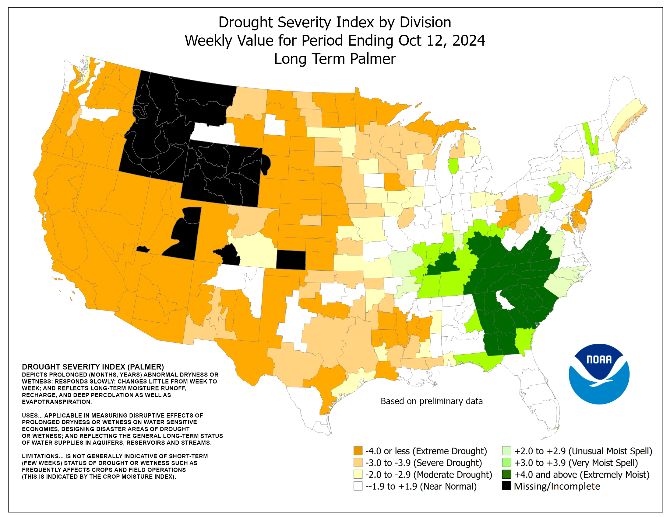
Vermont isn't yet officially in any kind of drought, but some parts of the state are regarded as "abnormally dry" according to the Palmer Drought Severity Index.

A few more rain showers might pop up on Wednesday, but they won't amount to much. After that, we get another stretch of dry weather with low humidity into next weekend. Temperatures will warm back up to the low 80s by next weekend.


Tuesday, November 11, 2014

Arctic Cold Front: Summer To Winter In Minutes

It is pretty obvious where the cold front was
in this temperature map from Monday.  
They weren't kidding when they said a big Arctic cold front would knife southward across the Plains Monday.

The cold front raced southward and southeastward, causing some temperature contrasts and changes in weather conditions that were some of the most rapid I've seen.

At one point Monday, depending on where you were in Iowa, it was between 27 and 72 degrees, depending upon which side of the cold front you were on.

In Denver, temperatures at one point fell at a rate of a degree a minute. It was in the 60s in Denver before the cold front arrived on Monday. This morning, it's 12 degrees.

Down in the Texas panhandle city of Childress, it was 87 degrees on Monday. This morning, it's 30 degrees.

The cold front, racing southward, was clearly visible on satellite pictures. It created a broad haboob, or dust storm in the High Plains of eastern Colorado and surrounding areas, as the front was accompanied by wind gust of more than 50 mph.
This satellite photo shows a dust storm along
the leading edge of the cold front in southeastern Colorado  

The haboob looked on satellite images like snow being pushed ahead of a plow.

Which kind of fits, because a lot of areas in the Plains have, or will have, enough snow to plow in the coming days.

The cold front blasted southward faster than it is moving eastward, as the initial push of Arctic air was directed more south than east.

But the front is trudging eastward, and the East Coast will feel it by later Wednesday.

It will get chilly in the eastern United States over the next few days but not super, super cold. But the chill will deepen as we head into next week.

In the frigid Plains and Midwest, don't look for any relief from this early winter weather anytime soon. The cold air might have come in fast, but it's going to stick around.

The weather pattern is getting stuck again. There's a big ridge that is setting up near the North American west coast, and a big southward dip in the jet stream into the central United States. That really weird, extreme jet stream pattern looks like it will stay in place for at least the next two weeks, probably longer.

Expect lots of winter weather, and several threats of snow in most places east of the Rockies and away from the Gulf Coast for the rest of the month.

Saturday, September 6, 2014

Is That Hot Spell We Had In The Northeast The Last One Of The Summer?

It was hot and humid late Friday afternoon
at my home in northern Vermont, but
some of my trees are already saying "autumn"  
True confessions time:

I'm an avid gardener, to the point that, when I have time, I put on a headlamp and go outside to play in the dirt. Especially if it's a gorgeous night.

Last night around my house in St. Albans, Vermont, it was magical.

Well past dark, it stayed very warm, close to 80 degrees. However,  a steady, strong south wind kept it comfortable.

A bright, nearly full moon shone, lighting up a few ragged, fast moving clouds in the sky.

It's September, so most of the bugs are gone, and the wind kept the last few stragglers away. I worked in the gardens for a few hours, then, around 10 p.m, felt so content, I lay down on the grass and fell asleep for more than an hour.

Faint flickering light woke me up. While I was asleep, thunderstorms formed just to my north and east, and then raced into nearby southern Quebec. The flickering I detected was lightning, just southeast of Montreal, about 60 miles away.

I say all this to,  yes, demonstrate what a batshit crazy weather geek I am, and also to say, last night might have been a crowning last hurrah, and a goodbye to summer.

Each of the first five days of September in Burlington, reached into the 80s, which is quite a stretch of summer weather for this late in the season. The end of summer is nigh, though.

That lightning I saw was the first sign a cold front was approaching. This Saturday morning it's cloudy and threatening, but the summer warmth and humidity remains. But not for long.

This cold front will usher in somewhat autumnal weather.  Some of the storms will drop briefly heavy rain across Vermont.

More importantly, there's the risk of severe storms, maybe even a supercell, in southern and eastern New England later today. The area most likely to see a few severe storms is a zone from Connecticut, through western and central Massachusetts, and on up into most of New Hampshire and Maine.

There's even the slight chance that area could see a brief tornado.

Sunday will be nice, but again, slightly autumnal in the Northeast. And we will have bouts of pleasantly warm weather well into the autumn, as we almost always do.

But that beautiful summer night I embraced last night, and the several day stretch of  rather hot, humid weather we had for the past few days probably won't be repeated again in New England.

At least until next summer.

Wednesday, September 4, 2013

So, So Easy To Find Today's Cold Front

Talk about easy!
Hmm, now just where is that cold front?
Yep, right there.  

Any bozo could figure out where the cold front was today, the one that promised to bring a crisp fall day to the Northeast on Thursday and frost to some of the colder mountain valleys Thursday night.

The National Weather Service in South Burlington, Vermont released a satellite image of the Northeast, takem this afternoon.

You can click on the image to make it bigger and even more easy to read.

Finding the cold front is no difficult, Where's Waldo task, is it?

Often, in the summer, it's hard to find weak little fronts and disturbances that would influence our weather, unless you know how and where to look.  Since these summer weather features are so hard to discern sometimes, you get an inaccurate forecast every once in awhile.

As we transition to fall, weather systems tend to become more obvious.  And easier to track, too.  As we get more toward winter, the weather systems remain obvious, but grow bigger and more complex. So cold season forecasts aren't always easy, either.

No wonder forecasters pretty much nailed the timing and strength of today's cold front. It was practically shouting out its position.

Thursday, August 22, 2013

Today's Northeast Thunderstorms: Meh!

A cold front is coming into the Northeastern United States today, which will at least temporarily rout the very warm and humid air sitting over the region.
A thunderstorm erupts over Vermont
in 2011. Thunderstorms in the Northeast
today are expected to be mostly not
too severe  

A change in airmass like this can often lead to severe thunderstorms, but we're starting to get past the time of year when such storms develop. The sun's angle is lower, the amount of heat available to generate storms is down a bit, so the biggest storms are a little less likely.

Severe storms are still quite possible this time of year, of course, if there's enough energy in the atmosphere as a cold front plows into August Dog Day air.  For instance, severe storms hit parts of Vermont around this time of year in 2011. And there is an occasional tornado in the Northeast this time of year.

Today's cold front doesn't have all the right ingredients to promote a widespread severe storm outbreak.  The upper level winds aren't that strong. The wind doesn't change directions that badly with elevation, so it'll be hard to get a lot of violent storms.

Quite a few places will hear thunder, and one or two spots might get a marginally severe storm. But this cold front is going to be pretty quick and benign, so don't expect huge amounts of drama.

This cold front is setting us up for a great weekend, with cooler, drier, sunny weather expected for the most part over the next three days.