Showing posts with label Tropical Storm Erin. Show all posts

Wednesday, August 28, 2019

Possible Bad News With Tropical Storms Dorian, Erin

Tropical Storm Dorian east of Puerto Rico early this morning. It's
looking more organized than it did yesterday.
As expected, forecasts keep shifting for Tropical Storm Dorian, and as of now, the news is worse for Florida, which could end up taking a nasty hit.

Land interaction, which could have potentially killed Dorian if it went over Puerto Rico or especially the Dominican Republic.  

Now it looks like Tropical Storm Dorian will just clip eastern Puerto Rico before head northwest into warm, open waters, where it could strengthen. That means it won't be over land long enough to get destroyed.

Top sustained winds with Dorian this morning were up to 60 mph, and the Natonal Hurricane Center says the storm definitely looks better organized than yesterday.

Dorian is going to cause problems in Puerto Rico and the Virgin Islands today. Puerto Rico is especially vulnerable. Their electrical system is still a mess after Hurricane Maria two years ago. Tropical storm force winds will be enough to wreck the lines once again.

Even more so than yesterday, Florida had better watch out for Dorian. It will be mostly over open water as it moves northwest, then west toward Florida, as it stands now.

Very often, a tropical storm or a hurricane heading northwest near Puerto Rico will curve harmlessly out to sea. But a large high pressure system over the western Atlantic Ocean looks like it will get in the way, steering Dorian westward toward Florida.

The National Hurricane Center says computer models have Dorian strengthening into a hurricane by Friday and remaining a potentially strong hurricane as it nears the northeast Florida coast on Monday. The NHC also says the hurricane would grow larger in size with time before it hits Florida.

This of course is a preliminary forecast, and the eventual path and strength of Dorian could end up being very different from current forecasts.

But if this prediction stays on track, this would be a rare hurricane hit for northeast Florida. The coastline there sort of curves inward, and hurricanes tend to hit either further south in Florida, or up the coast in the Carolinas.  This one could be serious, and we need to keep an eye on it.

TROPICAL STORM ERIN

That tropical depression off the East Coast yesterday has strengthened into Tropical Storm Erin. It only has sustained winds of 40 mph and won't get much stronger, says the National Hurricane Center. It will also stay well off the East Coast and eventually come ashore somewhere near Nova Scotia late Thursday or early Friday.

So no problem, right?

In this case, wrong. Or at least kinda wrong. A cold front that will give us showers here in Vermont later today will keep trucking deeper into New England. That will draw tropical moisture from Erin northwestward into eastern New England.

Flash flood watches are up for eastern Maine, coastal New Hampshire, eastern and central Massachusetts and Rhode Island later today and tonight. The worst downpours will be hit and miss, but a few spots could get four or five inches of rain in a short period of time, so that's a problem.

Rainfall might be locally  heavy in southeastern Vermont, too, but it likely won't be bad enough to cause any issues.

Monday, June 15, 2015

More Big Flooding, And Will Tropical Storm Make It Worse?

What might become Tropical Storm Bill
forming over the Gulf of Mexico Sunday. 
Flood and flash flood warnings and watches were scattered across different parts of the nation this morning as a wet early summer continues in many areas.

It's about to get worse, and some place - like Texas and Oklahoma - that suffered enormous floods last month are going to get slammed again.

There's two main ingredients to this latest bout of flooding. One is a strong ridge of high pressure causing a torrid heat wave in the southeastern United States.

That high pressure is steering lots of moisture from the Gulf of Mexico toward the Texas and Louisiana coast,  up into the southern Plains, then into the Ohio Valley.

Worse, a tropical storm is trying to form in the western Gulf of Mexico. If it forms, they'll name it Bill. 

Hi, Bill.

Bill will never be a powerhouse in terms of wind, but boy will it bring a lot of rain! That's true even if it doesn't get strong enough to get the name Bill.

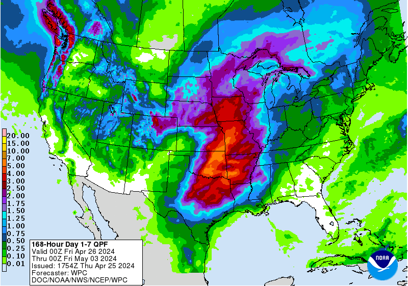
A great huge arc from eastern Texas, on up into Missouri, the Ohio Valley then east to maybe the New York City area, New Jersey and southern New England could get at least four to eight inches of rain in the next week. Locally more, even, especially the more south you go.

Since most of these areas are already quite wet, the flooding over the next several days could get quite intense. People in this great huge arc of predicted wetness might want to build an ark.

Here's a geeky, interesting thing about would-be Tropical Storm Bill.  Tropical systems and hurricanes rely upon warm ocean water to maintain their strength. Virtually always, tropical storms and hurricanes weaken quickly once they get on to land, largely because the friction of the land slows the winds, and the ready supply of moisture from the ocean isn't there anymore.

(However, tropical storms remnants can cause heavy rain and flooding far inland, well after the winds have died down.)

In would-be Tropical Storm Bill's case, there's a chance it could maintain its strength well inland into Texas and Oklahoma.

This has happened at least once before. In 2007, Tropical Storm Erin moved ashore in the western Gulf of Mexico and quickly weakened once it got over land, as most tropical storms do.

Once it got into Oklahoma, though, favorable upper level conditions helped maintain it. Also, the flat ground of Oklahoma was very wet from previous rainfall. Erin pretty much redeveloped into a tropical storm, complete with winds of 60 mph, spiral rainbands and an eye characteristic of tropical storms and hurricanes.

The National Hurricane Center called it just a low pressure system at this point, but it had all the characteristics of a tropical storm.

Atmospheric scientists Theresa Anderson and Marshall Shepherd studied this, and said wet, flat earth can mimic the ocean's rich moisture source  in some cases to encourage inland tropical storms like Erin. They called this the "Brown Ocean Effect."

Since Texas and Oklahoma are so wet right now, maybe Bill will become or maintain itself as a tropical storm in the southern Plains like Erin did eight years ago?

Maybe.  If the "Brown Ocean Effect" helps Bill maintain its strength once it's well inland, that would likely worsen the flooding that's already almost a sure bet.